

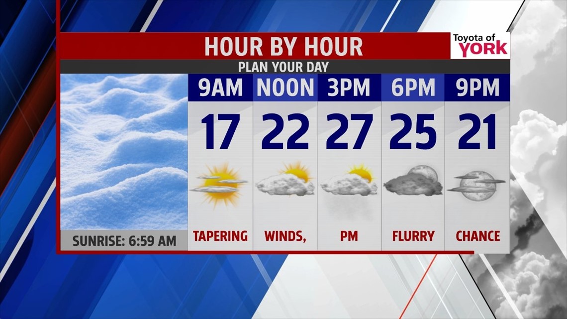
QUIET END TO WEEKEND

Flurries continue to dwindle across the region this evening, and that trend continues overnight. Skies partially clear leading way to a return to frigid nights. Lows fall into the teens, with locations to the northwest likely touching the single digits. There’s sunshine to start Sunday, but a weakening upper level piece of energy drops down through the day. This increases clouds and brings the chance for flurries or snow showers during the afternoon. A dusting to half of an inch is likely at best, mainly to the northwestern parts of the region. Highs are in the 20s.
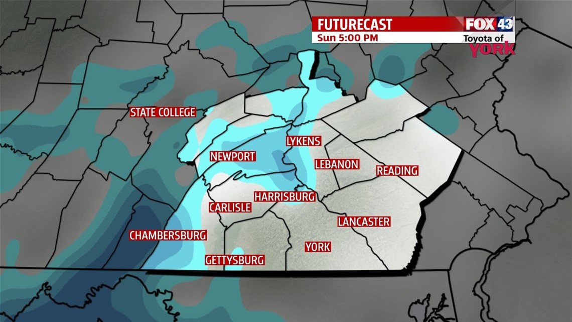
ANOTHER ROUND OF SNOW
Monday is a cold and quiet day for the Lower Susquehanna River Valley. Expect a sunny and frigid start. Clouds start to build during the afternoon ahead of our next storm system. This next system impacts us overnight Monday into early Tuesday morning, and it looks to bring another round of snow. Currently it looks potent enough to bring another 2 to 5 inches of snow to the region, perhaps a little more if current trends continue. After the system exits Tuesday, skies clear and temperatures rise into the upper 30 to lower 40s.
WARMING UP
It may be hard to believe, but temperatures rise well above seasonable averages from the middle to the end of the week. Highs reach the 40s Wednesday and Thursday. Thursday our next system brings a chance for showers late in the day through early Friday. Skies clear out Friday, and temperatures could reach the 50s! Then yet another system brings the chance for showers come Saturday.
Enjoy the rest of your weekend!
-Andrea Michaels