

TIMING: Snow will move in as early as 10pm in our western counties then spread quickly to the east especially after midnight. Snow may be heavy at times overnight. It will start to taper off in the late morning but may mix as warmer air intrudes in our southeastern counties.
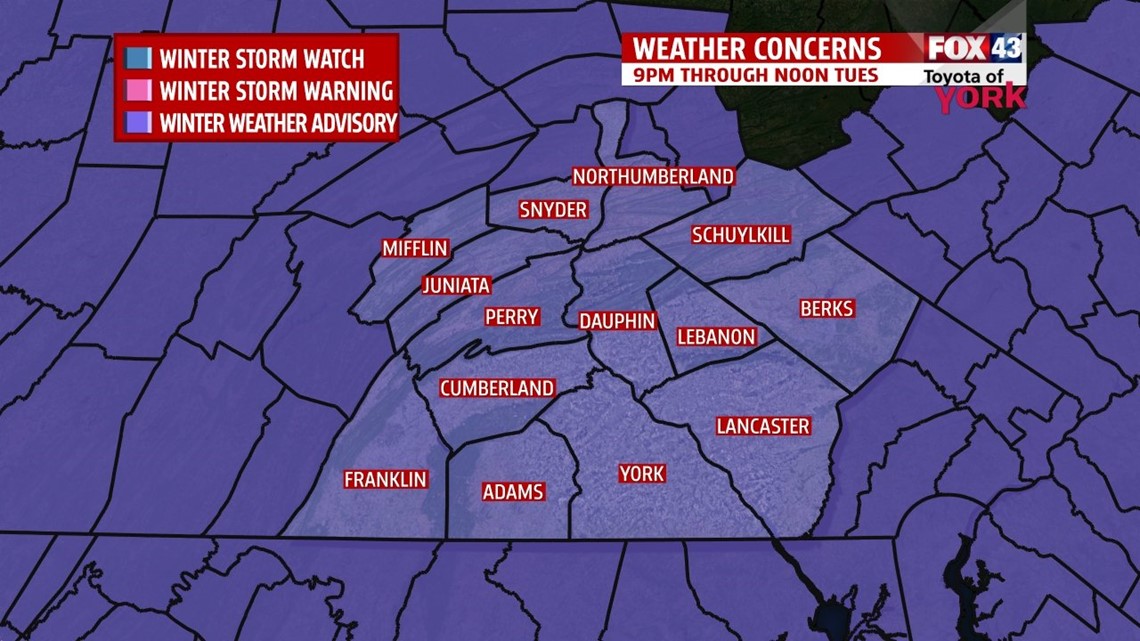
IMPACTS: Traveling may be hampered or slowed by heavy snow or blowing snow, visibility may be lowered and roads will become slick and could become covered with a thin layer of glaze in spots, especially south, as the storm ends.
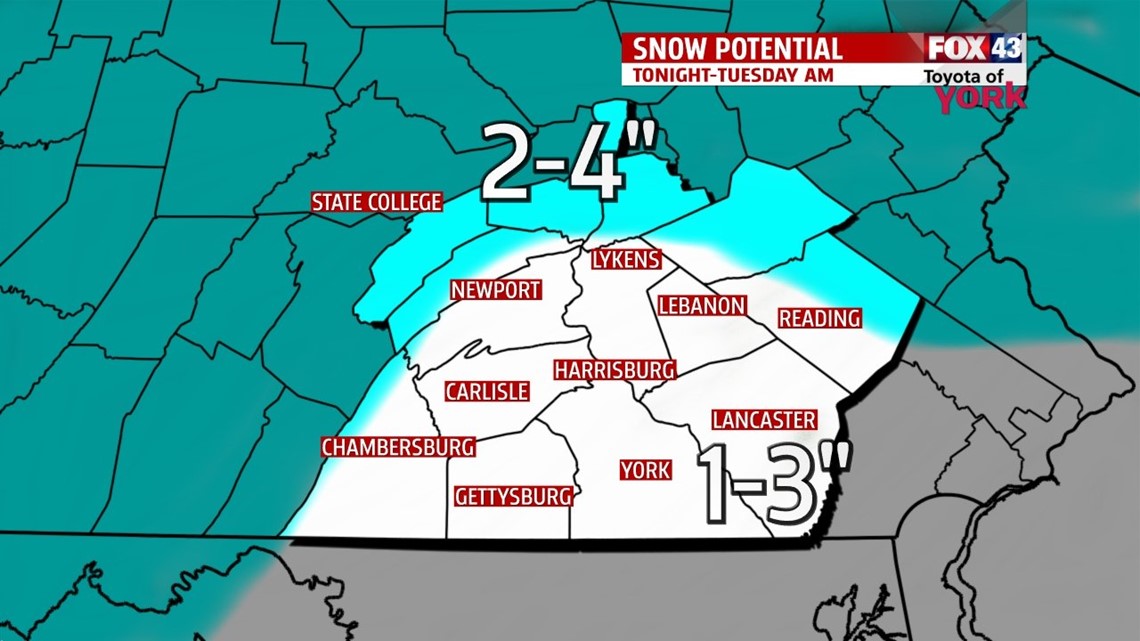
AMOUNTS: Looks generally 1 to 3 inches across most of the area. Higher amounts in the mountains from Mifflin, Juniata over to Northern Dauphin County may see 2 to 4” of snow.

REST OF WEEK: Tuesday afternoon we could get some peaks of sunshine and highs should get into the upper 30s. By the middle of the week, partly cloudy skies with just a few stray showers possible, highs finally into the middle 40s! Thursday we are even warmer with mostly cloudy skies and maybe an isolated shower. Friday will bring the best chance for rain as a potent storm system rides in. Despite wet weather, temperatures look to make into the low 50s to end the week.
WEEKEND OUTLOOK: Looks like cooler air returns for the weekend as Friday’s storm pull away from the area. Temperatures will still be above average in the lower to middle 50s. We start the weekend dry but may dodge a few showers Sunday.
Be careful in the morning and enjoy the rest of the week and the milder temperatures to come!
MaryEllen Pann, Chief Meteorologist
Like me on Facebook: maryellenpannfox43
Follow me on Twitter: @MaryEllenFox43