
OVERVIEW: Warm front is driving northward right now and is producing stray showers mainly north and west of Harrisburg. Can’t rule out a shower further south and east within the next two hours. Best chance for rain returns tomorrow when a cold front swings through by noon time. Temperatures will be mild in the 50s. Temperatures still look mild for the start of the weekend. High pressure returns for Saturday before yet another weak boundary heads our way overnight into Sunday. This will usher in colder air for early next week. An upper level trough builds back along with several disturbances that rotate through reinforcing colder air Tuesday and Wednesday. Our temperatures will plummet below average once again. Still watching the Tuesday-Wednesday time frame as models hint at either a clipper or coastal, either of which, could bring light snow.
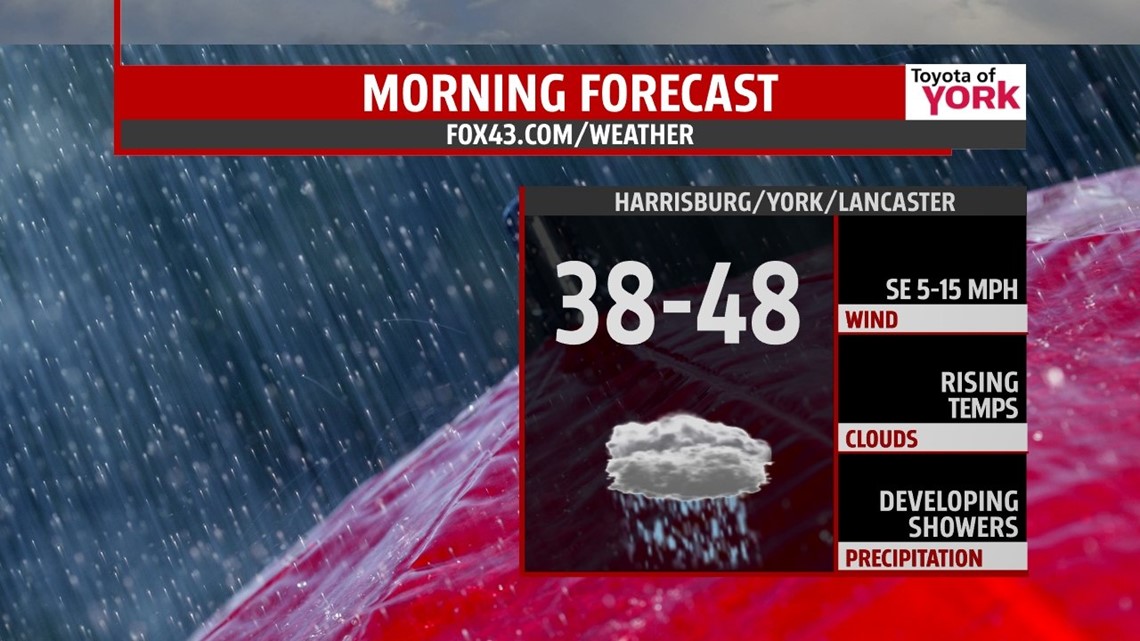
TONIGHT: Clouds thicken and while temps may drop heading into the evening, they are expected to start warming overnight into the morning hours. Lows will range from the upper 30s to upper 40s by morning.

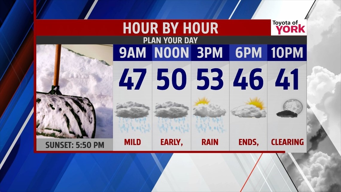
FRIDAY: Rain develops towards the second half of the morning commute and continues through about 1 or 2pm before exiting. Right now the severe weather threat remains to our south across Virginia and Southern Maryland; however, the winds could get quite strong and gusty with the passage of the front. Thunderstorms are not out of the question either. Slow snow melt and .5” of rainfall or more may result in minor flooding in poor drainage areas and along smaller creeks and streams. Ice jams while a concern, are being monitored.

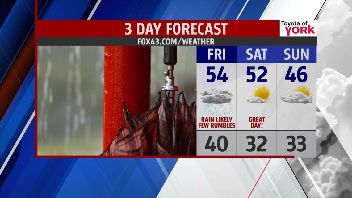
WEEKEND OUTLOOK: We start the weekend dry, mostly sunny and mild with highs in the low to mid 50s. However, the next system moves in Saturday night into Sunday ushering in colder air and it is possible we may dodge a few light rain or snow showers. System is not showing a lot of moisture so anything we get will be light, high temperatures will still be running above average in the mid 40s but the colder air spills in heading into the work week.

COLD SHOT RETURNS NEXT WEEK: Upper level trough digs and deepens over the east coast next week, bringing yet another invasion of Arctic air, which is reinforced several times with weak disturbances rotating through the trough. Also, looks like a weak clipper or coastal may bring a few snow showers for Tuesday into Wednesday. We are still monitoring since the models are showing different scenarios.
Enjoy the rest of the week and the milder temperatures to come!
MaryEllen Pann, Chief Meteorologist
Like me on Facebook: maryellenpannfox43
Follow me on Twitter: @MaryEllenFox43