
OVERVIEW: Northwesterly flow keeping things very cold this evening. There will be two disturbances that roll through, one tomorrow morning, the other, Wednesday morning. Both could bring some light snow. A deepening trough settles in over the northeast and will reinforce the colder than average temperatures for the rest of the week into the weekend.
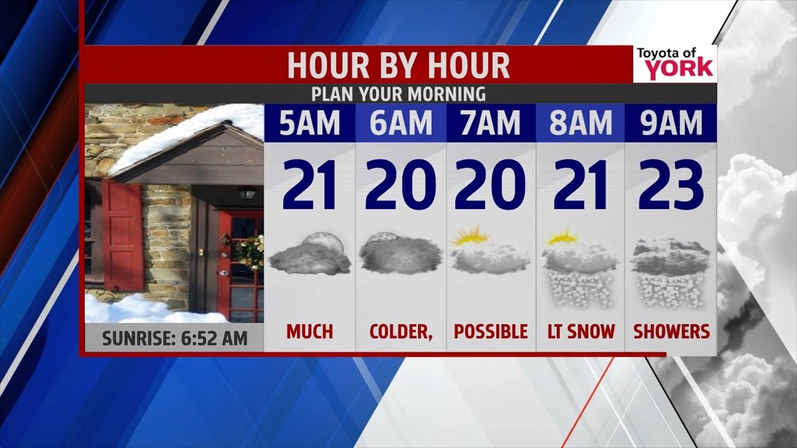
TONIGHT: Winds ease up a bit but will still be breezy. Mostly clear for a few hours then clouds return overnight as upper level energy dives in from the northwest. Lows will be very cold in the upper teens and low 20s. Light snow will be possible heading towards the late morning hours.


LAST FEW DAYS OF FEBRUARY: The coldest air of the week invades late Wednesday night into Thursday and Friday as temperatures plummet to 10° both mornings, and despite sunshine, highs Thursday will only reach the upper 20s, we do a bit better Friday with highs near 30°.

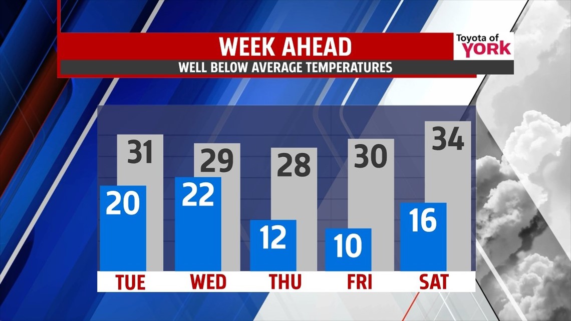
MARCH IN LIKE A LION OR LAMB: Well no major storms for the first day of March and it looks like temperatures will warm to the low to mid 30s but a few snow showers are possible as a clipper type system rotates in. Sunday will be quiet but colder with lows around 20 and highs in the low 30s. Best chance as of now for seeing accumulating snows will be Monday. We’ll have to watch the development of a storm that could bring snow to the area.
Bundle up and stay warm this week!
MaryEllen Pann, Chief Meteorologist
Like me on Facebook: maryellenpannfox43
Follow me on Twitter: @MaryEllenFox43