
OVERVIEW: A deep upper level trough will remain parked over the area for the rest of the week spelling out a continuation of below average temperatures. The colder air is reinforced each day by fast moving short waves, the first of which, may bring a chance for light snow tomorrow morning. Our next system lifts out of the southwest with a boat load of moisture for Sunday and Monday. Track will be key to the type of precipitation we get. Right now it looks like we could see a little bit of everything from snow, to sleet, freezing rain and rain.
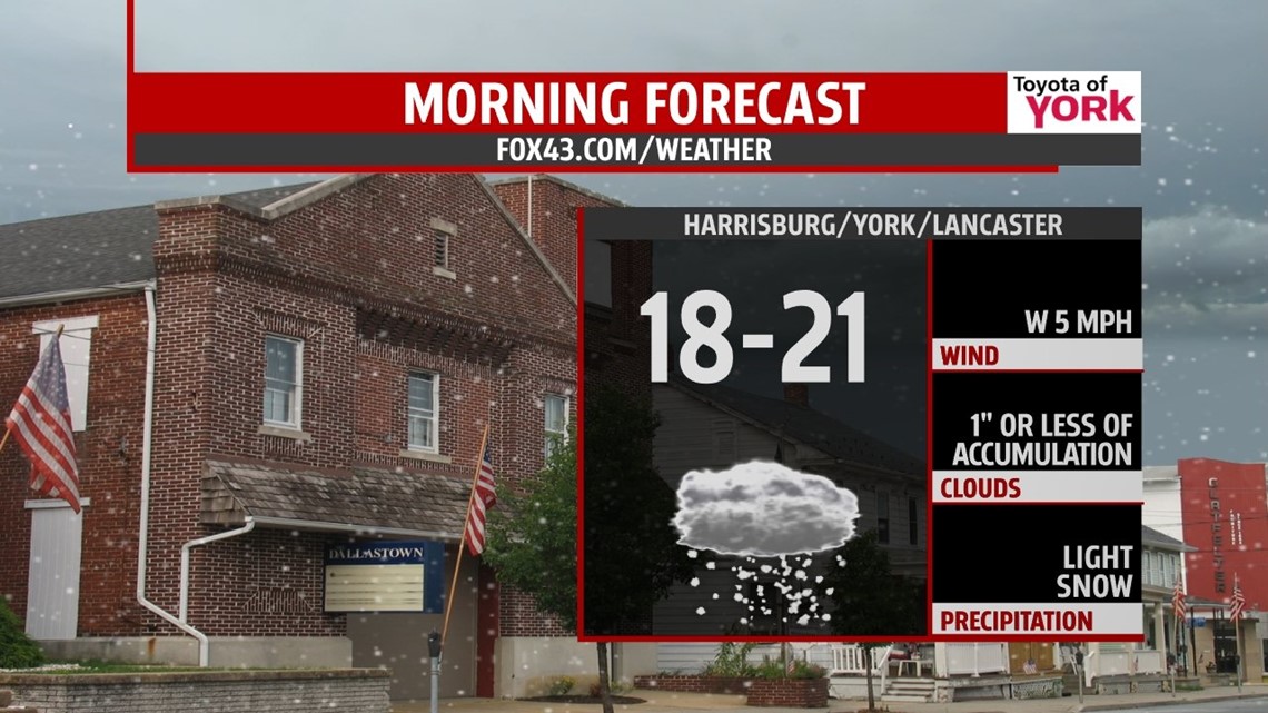
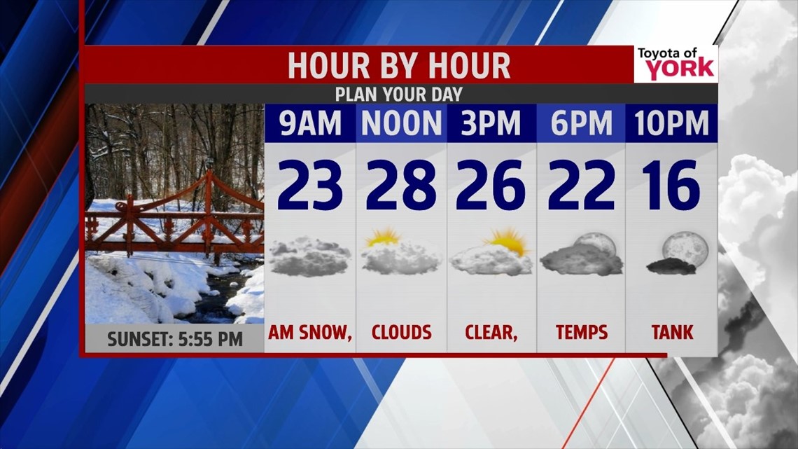
TONIGHT: Clouds break up early but then thicken back up overnight as the next disturbance rotates in bringing light snow in time for the morning commute. An inch or less is expected so it shouldn’t be a big deal but snow will be falling during the morning commute which may produce some slippery conditions. Lows will tank to the upper teens to low 20s.


LAST FEW DAYS OF FEBRUARY: The coldest air of the week invades Thursday into Friday as temperatures plummet to the single digits and low teens both mornings. Despite sunshine, highs Thursday will only reach the upper 20s, even colder Friday, with highs slowly climbing to the middle 20s.
MARCH ARRIVES LIKE A LAMB: Well no major storms for the first day of March and it looks like temperatures will warm to the low to mid 30. Our next front approaches late Saturday night and may produce some flurries. The front doesn’t move south it stalls overhead. A wave of low pressure develops along it keeping it in the area then dragging it further north. This means we could see snow to start but warmer air is expected to move in from the south so any snow should mix then eventually change to rain. Highs Sunday will warm to the upper 30s. There will be a lot of moisture with this next system and with temperatures falling back to below 30 overnight into Monday, this introduces the concern for freezing rain as temperatures are expected to fall through the day. We could see a little bit of everything. Precipitation type will depend on track of storm and where temperatures end up. We’ll keep you posted.
Bundle up and stay warm this week!
MaryEllen Pann, Chief Meteorologist
Like me on Facebook: maryellenpannfox43
Follow me on Twitter: @MaryEllenFox43