
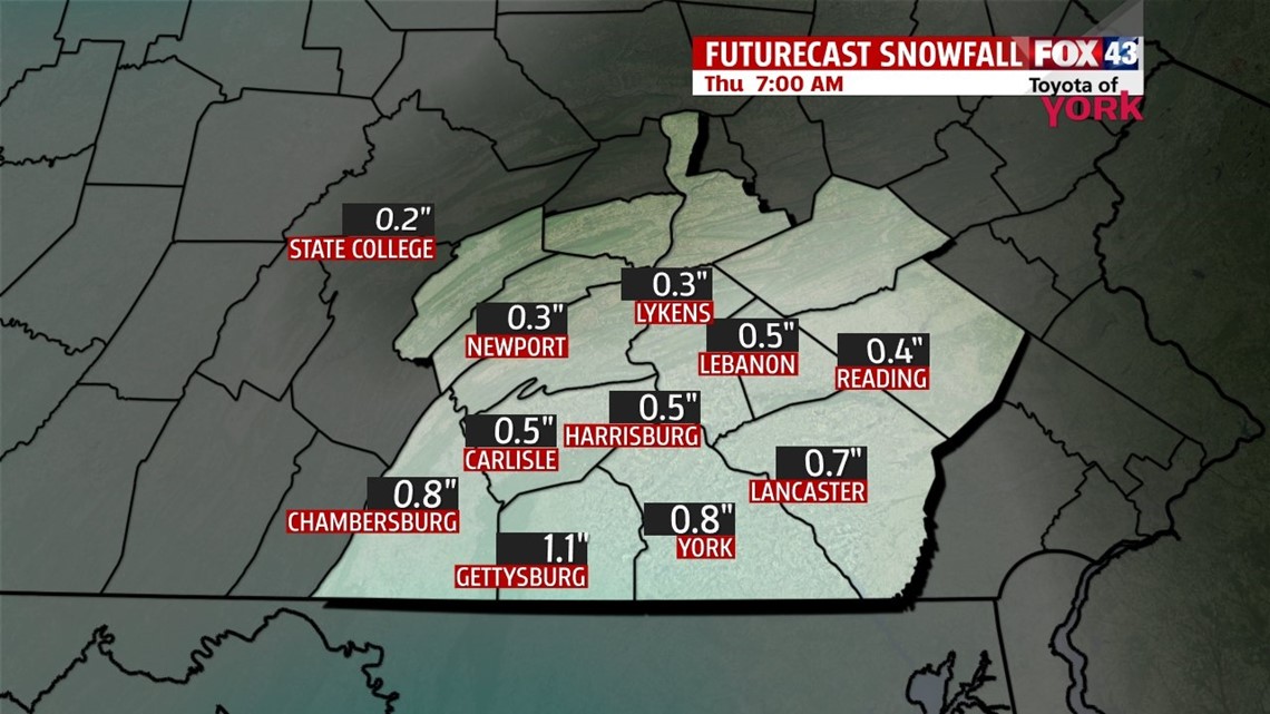
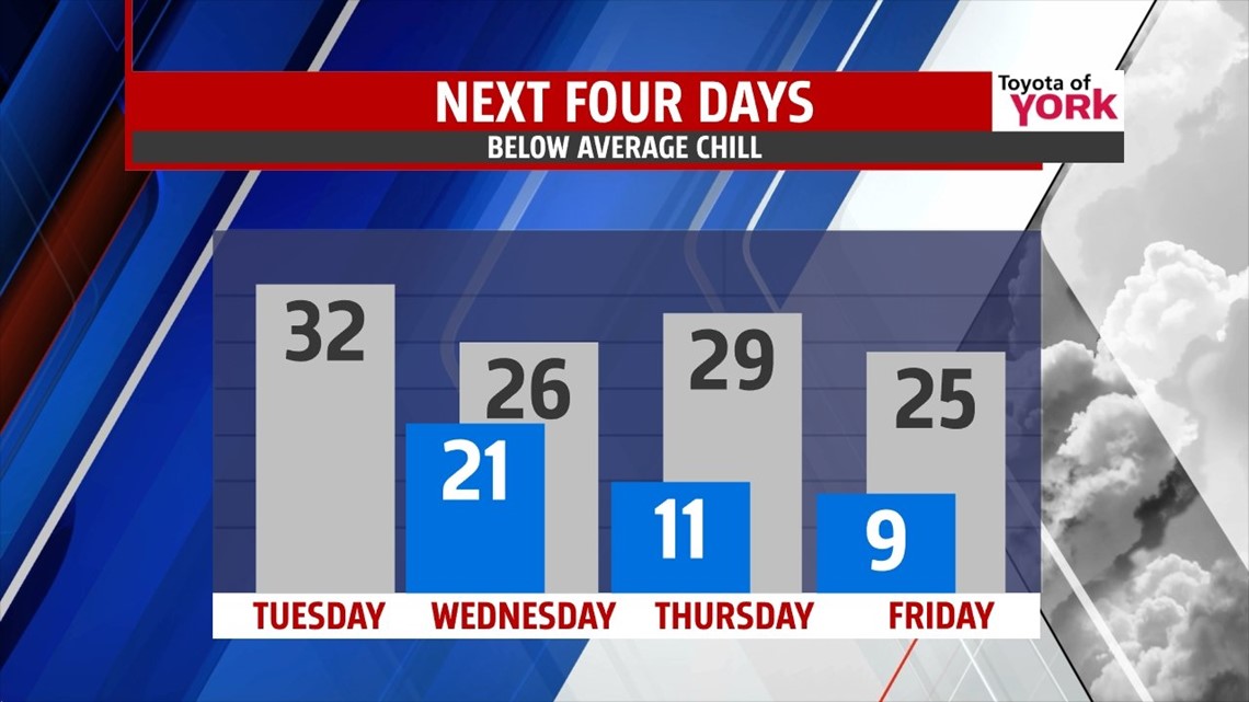
COLD REIGN: The cold air is with us all week long. Today, we deal with some light snow showers early. We don’t expect much to accumulate though and it’s done by midday. Highs hit the low 30s today under mostly cloudy skies early. We dip to the low 20s tonight. Another system brings a chance for some light snow overnight into the morning Wednesday. Snow showers may leave us with a light accumulation of snow. Highs only hit the middle 20s.

Late week, we’re seeing more sunshine with highs in the upper 20s Thursday and mid 20s Friday as another shot of cold air rolls in to close out the month. Lows are in the single digits and teens. Otherwise, it’s dry and quiet despite the below average chill locked in place.

WEEKEND +1: Another wave of energy will impact the weekend forecast. Right now, Saturday features mostly cloudy skies with highs in the middle 30s. A few flakes may fly, but it’s mostly dry. Sunday, a developing storm system to our west may force some light snow in as warmer air tries to nudge north as well. Highs are in the middle 30s. Models really want to warm this thing up in time for the bulk of the precipitation on Monday, so it looks like we could switch to a wintry mix Monday morning before turning to all rain later Monday. Highs on Monday are touching 40°. It’s 6-7 days away, so much can change. We’ll monitor it closely as the week progresses.
Make it a terrific Tuesday!
“Wherever there is a human in need, there is an opportunity for kindness and to make a difference.” – Kevin Heath
– Jeff Jumper, WPMT FOX43 Morning Meteorologist
Follow me on Twitter: @JeffJumperWX
Like me on Facebook: Jeff Jumper FOX43