
OVERVIEW: We end the week with frigid air in place for the entire day. High pressure moves east allowing a front to lift north. It returns Sunday morning ahead of our next moisture laden storm. The main part of the storm looks to move by to our south and that means we will be on the colder side of the storm. Significant, plowable snow amounts are likely. Below is more on the time-frame. Then it looks like colder weather returns for the middle part of next week.
TONIGHT: In the near term we have quick burst of snow moving through parts of the area. They can rapidly drop visibility but will move out fast. Winds are blustery. Wind chill readings are running in the single digits and low teens. High pressure will build in clearing our skies and will help to ease the winds after midnight. Lows expected in the lower single digits. A light breeze will cause wind chills to dip below zero.

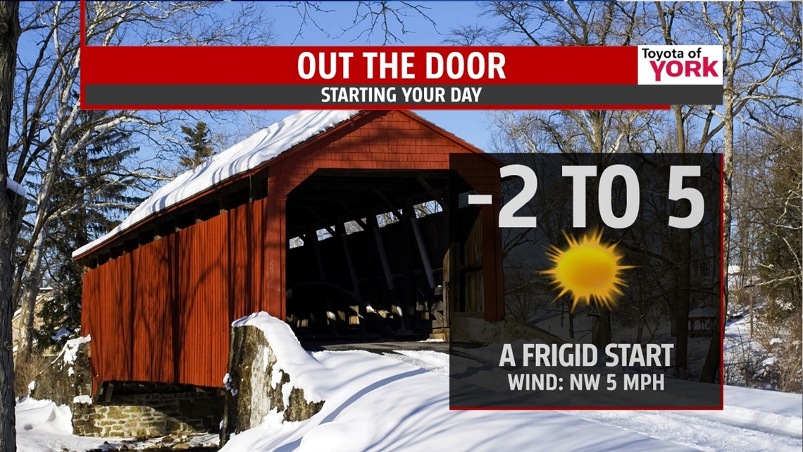
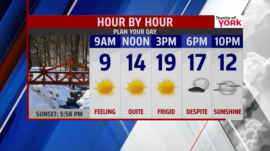
TGIF: Make sure you find a way to stay warm! It will be the coldest day of the week despite a sky full of sunshine. Blue skies will stretch across the area but with all that sunshine headed our way, highs barely get above 20°!! Clouds stream in late Friday night as the next front moves north to bring clouds and maybe a few flakes for Saturday otherwise partly sunny with temperatures finally climbing above 32 degrees! We should see low to mid 30s across the area.

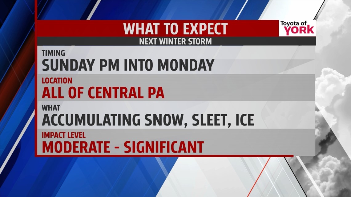
WATCHING ANOTHER SIGNIFICANT STORM: Our next storm comes in Sunday, and remains all day Monday into the evening. Modeling has been coming together nicely but we want to be sure of the continuity and consistency before issuing any snow amounts. It is looking more likely we will see less mixing and more snow. Initially, it will start out as rain, sleet and snow Sunday afternoon and evening and will be on the light side.

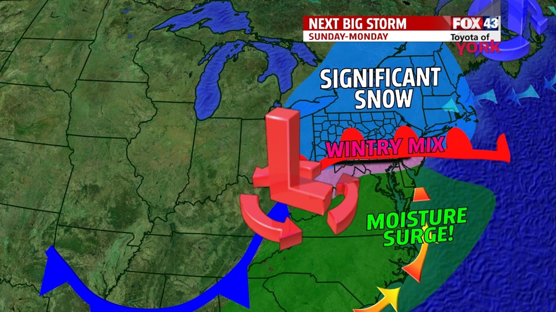
Overnight, there will be a period of snow and sleet mix before a transition to all snow for much of Monday into the evening. There will be a lot of Gulf moisture with this next system and that means we will see significant snowfall. We will put out snow totals tomorrow night.

Happy Thursday evening!
MaryEllen Pann, Chief Meteorologist
Like me on Facebook: maryellenpannfox43
Follow me on Twitter: @MaryEllenFox43