
OVERVIEW: A pretty powerful cold front will slam the area later this evening and will be followed by blustery, cold conditions. After a few days of well above average warmth, temperatures will plummet for Thursday. By Friday, we rebound to near seasonal averages as the next the system pushes eastward. The next front is poised to move through Saturday bringing showers with it.
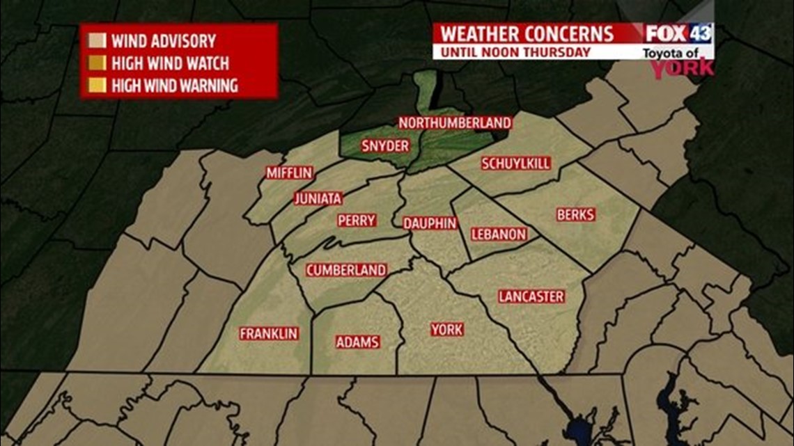
WIND ADVISORY IN EFFECT until Noon Thursday. Winds will be northwesterly 25 to 35 mph and may gusts up to 45 mph or more. Minor property damage possible. Downed tree limbs and isolated power outages possible. It may be difficult driving for high profile vehicles.

TONIGHT: Winds will continue to gust strong. Skies will partially clear and temperatures will fall very quickly to the upper teens but may feel more like the single digits to near zero with the gusty winds..

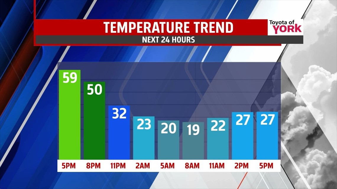
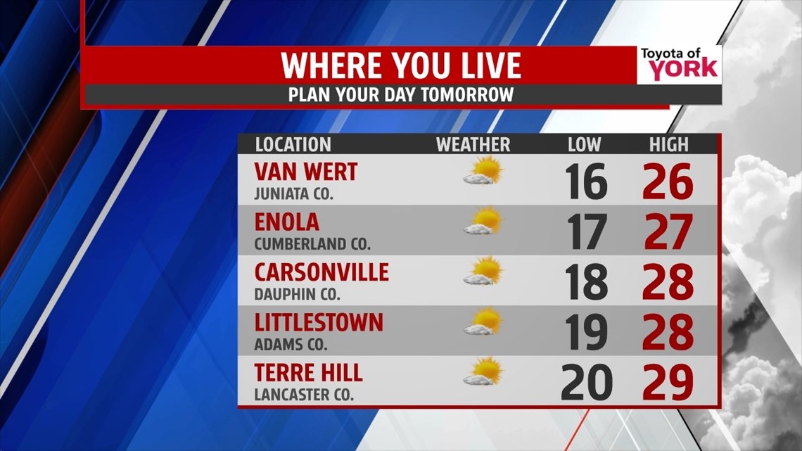
THURSDAY: It will be a brutal return to winter as the winds continue strong out of the northwest 25 to 35mph and temperatures remain in the 20s. But with the combination of the winds and colder temperatures, means wind chills will be running in the teens and single digits. Winds will gradually ease up heading into the afternoon. There could be several low-max temperatures in jeopardy as temperatures run well below normal. Thankfully, the cold intrusion will be short-lived.

FRIDAY: Looking pretty quiet to end the week. Winds shift to the west-southwest and help to get temperatures back to the 40s and 50s. Sunshine will mix with clouds as high pressure briefly moves in.
WEEKEND OUTLOOK: The next front arrives for Saturday bringing mainly a small rain chances as it does not look all that impressive. Temperatures be around average to start the weekend but may dip a tad below by Sunday but we will certainly end the weekend on a dry note.
EARLY NEXT WEEK: Looks like the typical pattern of this winter will return next week. That means a series of weak systems rotating through a trough anchored over the east coast. Colder air will spill in again from Canada as high pressure is position to our northwest. A storm system tracking to our south may inch in close enough St. Patrick’s Day to cause some concern for wintry precipitation. Confidence is low given the models are completely coming up with different solutions. We’ll be monitoring closely in the next few days.
Have a super Wednesday!
MaryEllen Pann, Chief Meteorologist
Like me on Facebook: maryellenpannfox43
Follow me on Twitter: @MaryEllenFox43