
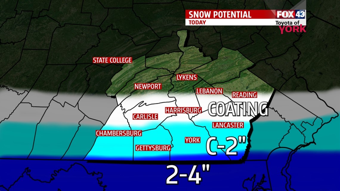
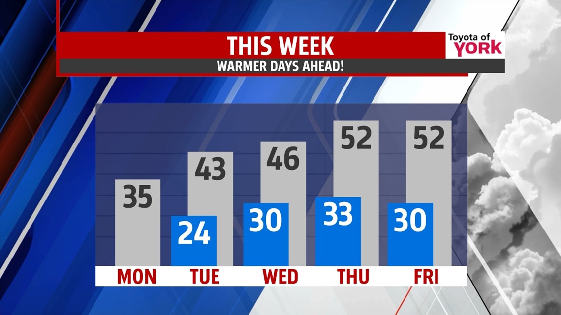
SNOW TAPERS: Good morning and Happy St Patrick’s Day! Some light snow greets us this morning, but it’s not amounting to much. Expect a coating from the turnpike corridor south, with around 2-3” or so closer to the PA/MD border. The snow tapers in the late morning hours. We then are left with some gradually clearing skies. Temps this morning are in the 20s and we top out today in the middle 30s. Tonight, we’re back to the 20s for lows with clearing skies.

NEXT UP: Tuesday features morning sunshine with more clouds returning later in the day. High hit the low to middle 40s. Clouds return along with our next storm system. We will see some freezing rain/rain mix late Tuesday into early Wednesday, which could make for a brief icy mess. However, temps will warm on Wednesday as warm air is forced in ahead of the front so we expect the changeover to rain to be quick. Highs Wednesday will hit the middle 40s.
MILDER: Despite the passage of the front, the strong March sunshine should help warm us on Thursday to the low 50s with some sunshine and scattered clouds and a breeze. Friday, more clouds roll in but southwesterly flow helps to warm us to the low 50s again.

WEEKEND: Our next system arrives over the weekend. We’ll see a mild and mostly cloudy Saturday with showers rolling through during the day. Highs hit the middle 50s. Then cooler air settles back in for Sunday into Monday next week. Temps drop to the 40s on Sunday.
Have a great Monday!
“Big thinking precedes great achievement.” – Wilferd A. Peterson
– Jeff Jumper, WPMT FOX43 Morning Meteorologist
Follow me on Twitter: @JeffJumperWX
Like me on Facebook: Jeff Jumper FOX43