
OVERVIEW: Breezy winds will continue this evening but high pressure building in from the south should help them to weaken a bit overnight. A warm front approaches late Friday afternoon bringing a few clouds to the area. The cold front swings through early Saturday morning with only a few drops possible. High pressure builds in and helps to funnel in much colder air for Sunday. We continue with below normal temperatures through at least the middle of next week and we could even see a few light snow showers late Tuesday into Wednesday as a storm rides up the east coast. It stays just far enough east that we just get clipped as of now with light snow.
THIS EVENING: A cold front pushed east today, winds have become quite gusty and remain that way for several hours before letting up as high pressure builds in from the south. Clouds will be clearing going into the overnight. Temps fall from around 50 to the low 40s during the evening.
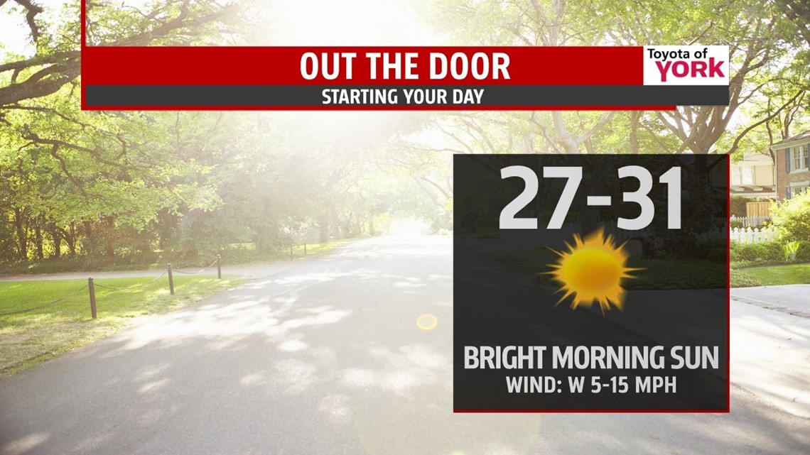
OVERNIGHT: Mostly clear skies, light breeze continues, lows dropping to the upper 20s to low 30s.

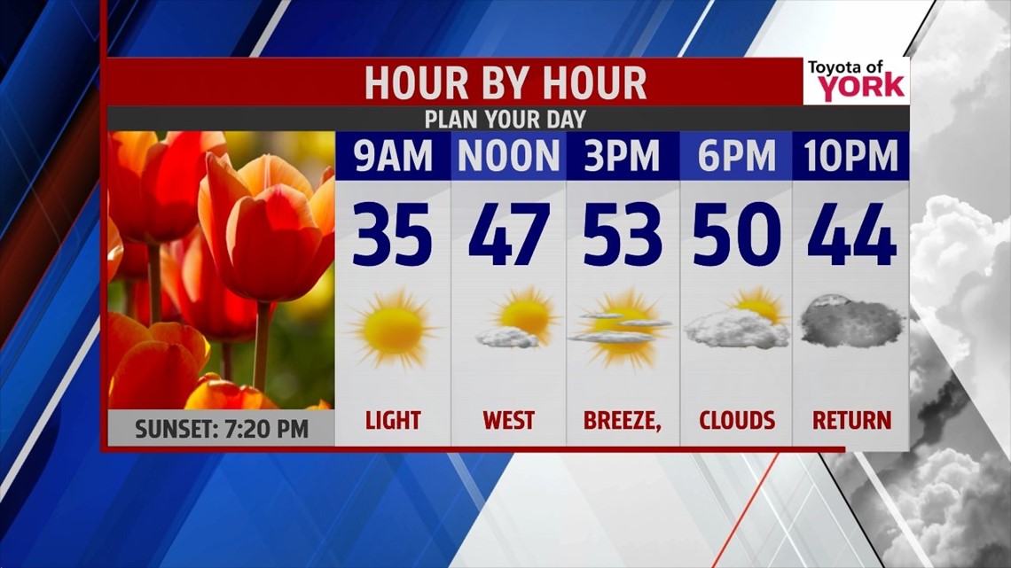
TOMORROW: A nice spring day to end the week. Mostly sunny with more clouds late in the day as a warm front approaches. Highs will once again reach the upper 40s to low 50s.

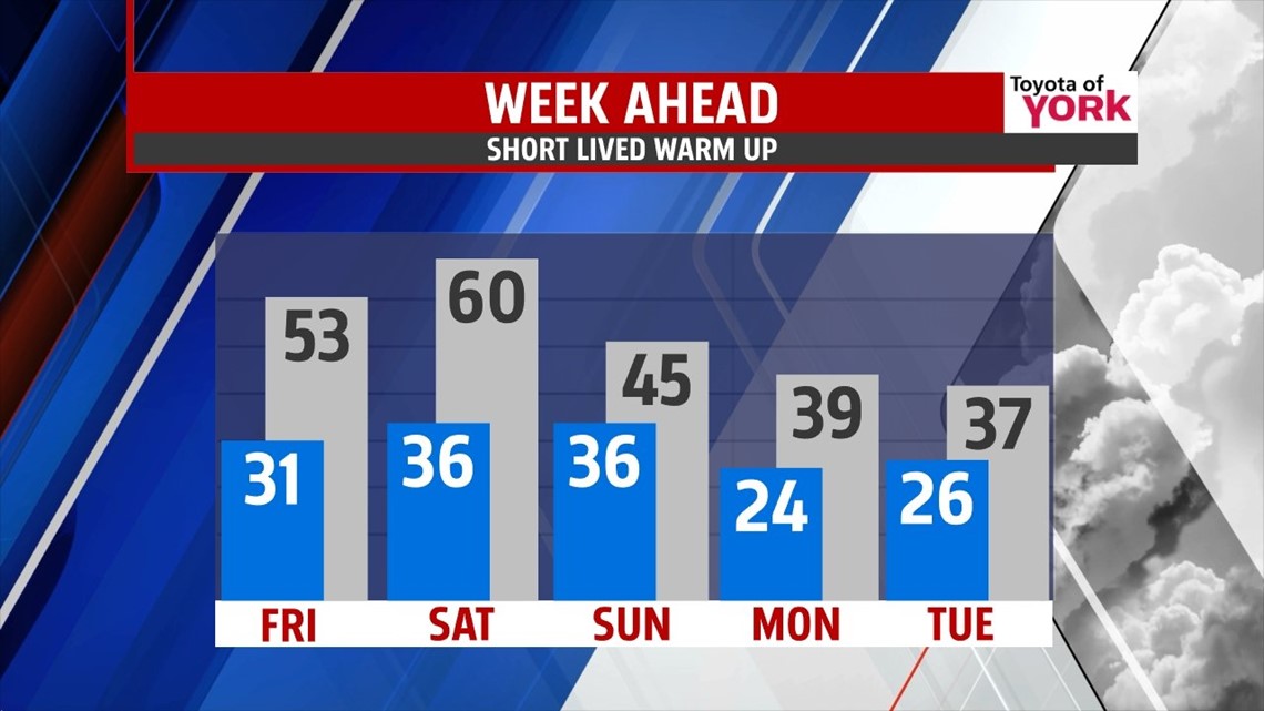
WEEKEND OUTLOOK: Another cold front comes in Saturday but with little moisture. A few showers possible early, then partial clearing with more sunshine heading into the afternoon. Still mild very mild with highs in the upper 50s to near 60 to start the weekend but colder air returns Sunday. High pressure will funnel in colder air Sunday producing highs only in the low to mid 40s along with breezy conditions. There is a small chance for a few drops but most of the day will be dry with sunshine mixing in and out of the clouds.
NOT DONE WITH WINTER JUST YET: Temperatures turn colder next week as an upper level trough digs in across the eastern third of the country. Light snow showers will also be possible Tuesday into Wednesday as an area of low pressure rides up the coast. At this point, it will bring nothing more than light snow showers as it is too far off the coast to impact us more significantly. We’ll certainly keep an eye on the trends and any changes.

Have a great day!
MaryEllen Pann, Chief Meteorologist
Like me on Facebook: maryellenpannfox43
Follow me on Twitter: @MaryEllenFox43