

NICE WEEKEND CONTINUES

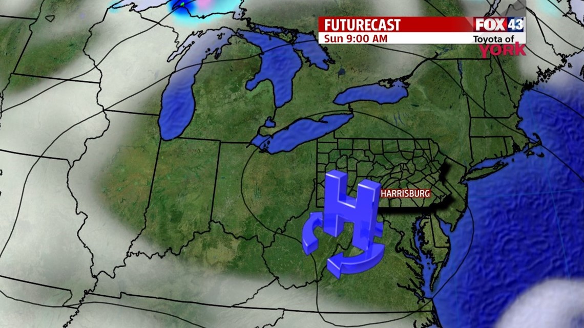
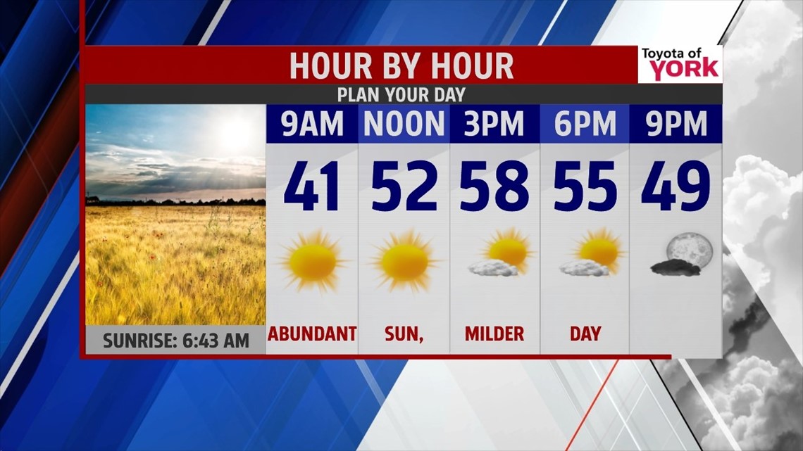
Lingering clouds across the region crumble this evening as high pressure continues to settle into the area. The breezes taper too through the night. It’s a clear one under clear skies, with low temperatures falling into the upper 20s to middle 30s. Sunday is filled with abundant sunshine, and temperatures are a bit milder too. Afternoon highs reach the middle to upper 50s throughout the area. It’s an overall spectacular end to the weekend.
NEXT RAIN CHANCE
Clouds quickly increase Monday with the approach of our next system from the south. Showers enter the picture during the afternoon hours, lasting through much of the night. A few could linger into early Tuesday, but overall it’s a dry day with plenty of clouds. Highs are in the middle 50s Monday and near 60 degrees on Tuesday. A cool push of air works in Wednesday, knocking temperatures down into the 50s again.
LATE WEEK WARMING!
A strong ridge of high pressure build off shore, and this help to warm temperatures into the upper 60s on Thursday. Expect a mixture of sunshine and clouds. It’s still mild in the 60s on Friday, but a weak cold front moves through and knocks temperatures down a few degrees. A few showers are also possible. Saturday, clouds clear out, and highs should still reach the 60s.
Enjoy the rest of your weekend!
-Andrea Michaels