

TURNING UNSETTLED

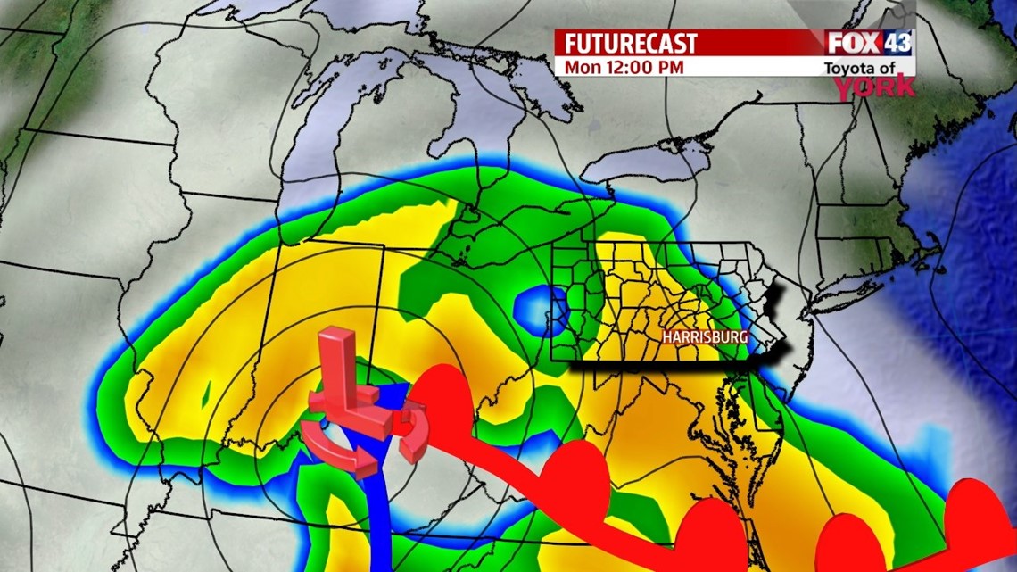
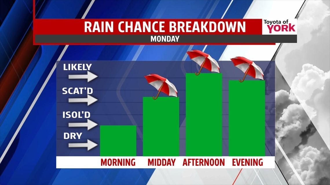
After a day filled with plenty of sunshine, changes begin to enter the picture through the night. The evening remains clear with temperatures falling quickly into the 40s. However, as a developing storm system to our south begins to shift north, clouds increase near daybreak across the area. Lows are not nearly as cold as this morning, and fall into the middle to upper 30s. Monday morning clouds quickly thicken up, with much of the morning commute staying dry. Then, by mid to late morning, showers begin to work into the area. By noon, expect widespread showers throughout the entire area. Temperatures stay rain cooled, so highs only reach the upper 40s to near 50 degrees. Total rainfall amounts through Tuesday morning range from a half of an inch to an inch, so no major problems are expected. Perhaps some elevated small creeks/streams and ponding on poor drainage roads once again at best.
DRYING OUT
A few showers could linger into early Tuesday, but overall it’s a dry day with plenty of clouds. Highs are near 60 degrees on Tuesday. A cooler push of air works in Wednesday, knocking temperatures down into the 50s again. It is a mixture of clouds and sunshine for Wednesday.
LATE WEEK WARMING!
A strong ridge of high pressure builds off shore, and this helps to warm temperatures into the middle to upper 60s on Thursday. Expect a mixture of sunshine and clouds. It’s still mild in the 60s on Friday, but a weak cold front moves through and knocks temperatures down a few degrees. Some showers are also possible. Saturday, clouds clear out, and highs still reach the 60s. By Sunday we’re looking at upper 60s!
Have a great week!
-Andrea Michaels