
OVERVIEW: Low pressure continues through the Ohio Valley, staying to our northwest, heading across Canada into New England. It will drag a frontal boundary across the area overnight tonight, followed by a secondary weaker front early in the morning. Cooler air funnels back into the area for Wednesday. High pressure moves back in to bring quiet, dry and milder days before the next frontal system arrives for Friday.
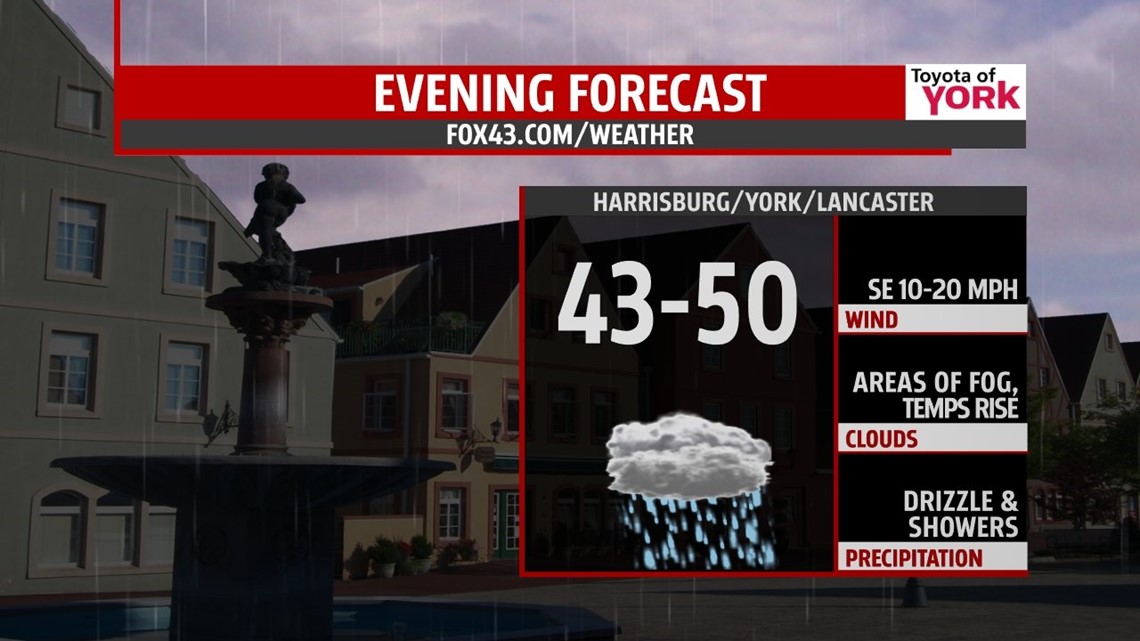
THIS EVENING: Light rain, areas of fog and slowly rising temperatures continue through the evening hours. Temps will warm from the low to mid 40s to around 50 by 10pm. They will continue to warm after midnight until the front pushes through.

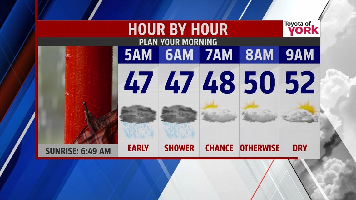
OVERNIGHT: The rain will become more showery and scattered overnight. First front comes through tonight while a second one swings eastward early in the morning. Temperatures after spiking to the 50s after midnight will fall back to the mid and upper 40s by morning. There will be a chance for showers very early in the morning drive but most will have dry conditions as they head out.

TOMORROW: Morning clouds give way to mostly sunny skies. Highs will rebound quickly to the low 60s. Winds will be breezy out of the west 10-20 mph with higher gusts making it feel chillier.

MIDWEEK: After a chilly start in the upper 30s, afternoon temps will be cooler in the 50’s for Wednesday despite sunshine. Thursday with the high setting up in the Atlantic, will provide a milder flow out of the south-southwest and should help to get our temps into the middle 60s under mostly sunny skies. Friday another weak front comes in. Timing is still a question but we should see a few showers in the afternoon and evening. Temperatures will still get to the mid 60’s even with the threat for wet weather.
WEEKEND OUTLOOK: Some models indicate the front may stall just to our south for early Saturday keeping a chance for showers around for the morning. I have put in a chance but anything that may fall will be light and quick. The rest of the day looks to be mostly sunny with highs in the upper 60s. Sunday looking even nicer with high pressure still dominating our weather and warmer temps with highs near 70 are expected.
STARTING WET NEXT WEEK: We stay mild for Monday but the next system will be approaching bringing an increase in clouds and the threat for showers late Monday. They are likely to linger into Tuesday. Highs Monday will still be quite pleasant in the mid to upper 60’s.
Have a nice week!
MaryEllen Pann, Chief Meteorologist
Like me on Facebook: maryellenpannfox43
Follow me on Twitter: @MaryEllenFox43