
OVERVIEW: A great looking Thursday with plenty of sunshine and southwesterly breezes to transport milder air across the area. A weak front will trigger a few showers and maybe a rumble of thunder for Friday. Weekend looks great with temperatures flirting with 70 degrees. Only a few drops possible early Sunday as a warm front pushes northward, otherwise, it will be dry. It will still be mild on Monday with thunderstorms late in the day. A greater threat for showers moves in overnight into Tuesday as a frontal system crosses the area. Cooler air returns behind the front for Tuesday and Wednesday.

THIS EVENING: It’s an outstanding evening with mostly sunny skies. Winds are still breezy but will relax later tonight. Temps will fall from around 60 to upper 40s close to 10pm.
OVERNIGHT: Mainly clear and chilly again with lows in the mid to upper 30s. Winds will be light out of the south.

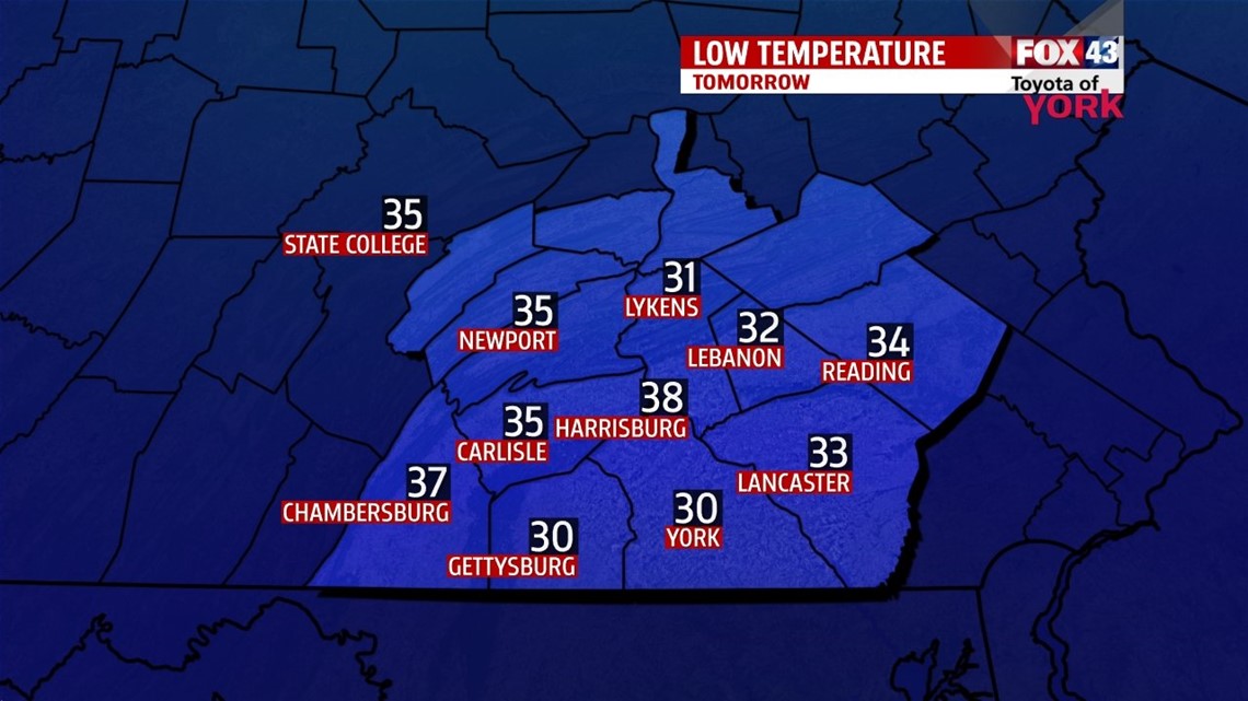
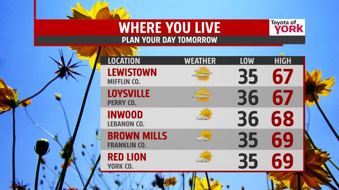
TOMORROW: It will be a day to spend outdoors. There will be plenty of sunshine with clouds holding off until late in the day towards evening. Highs climbing quickly to the upper 60s, as a south-southwesterly breeze kicks in bringing milder air.

REST OF THE WEEK: Friday another weak front comes in. We could see a few showers early in the day then again late afternoon along with the possibility of a rumble of thunder. Despite the clouds and possible rain, temperatures will still reach the middle 60’s.
WEEKEND OUTLOOK: Should be a nice weekend to look forward too. A little disturbance early Saturday keeps a small chance for a few morning drops otherwise, clouds will quickly clear and the rest of the day looks to be mostly sunny with highs in the upper 60s to near 70. Sunday, a warm front pushes north and may squeeze out a few drops early in the day but despite partly cloudy skies, it should remain mild and well above average in the low 70s.
STARTING WET NEXT WEEK: We stay mild for Monday with highs in the low 70’s again but the next system will be approaching bringing an increase in clouds and the threat for showers and thunderstorms late Monday. Showers will linger into Tuesday followed by cooler air as temperatures drop from the 60s to the 40s by Tuesday afternoon. Wednesday looks dry and sunny with highs in the low 60s.
Make it a great day!
MaryEllen Pann, Chief Meteorologist
Like me on Facebook: maryellenpannfox43
Follow me on Twitter: @MaryEllenFox43