

STAYING WARM & BREEZY

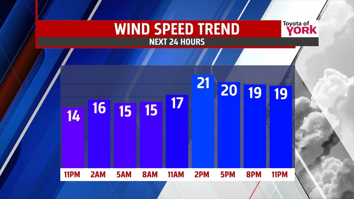
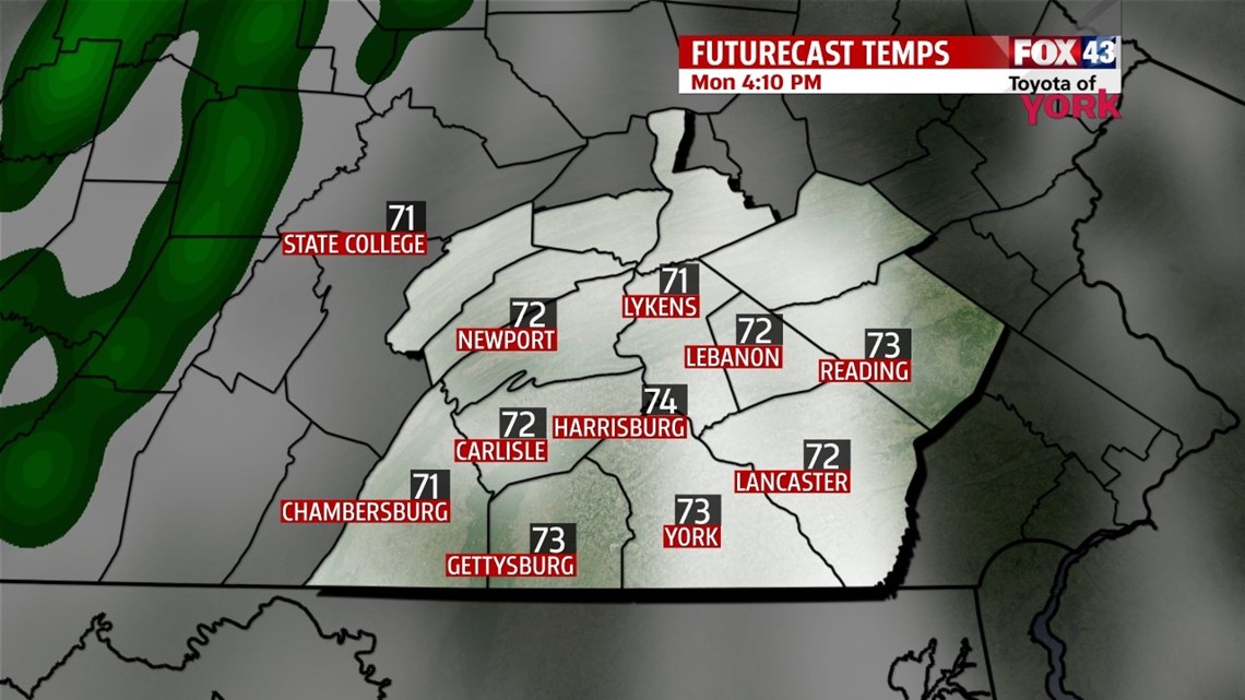
It’s a mild evening across the Lower Susquehanna River Valley after a very warm afternoon with highs in the upper 70s to lower 80s! Skies are mostly clear through much of the night, but some clouds start to thicken close to daybreak. Lows are very mild, falling into the upper 50s to lower 60s. It’s a bit hazy to start on Monday. Through the rest of the day, clouds quickly increase ahead of an approaching cold front. Highs reach the middle 70s. It’s another breezy day too.
NEXT SYSTEM
The cold front brings showers to the area Monday night. Heavier showers, perhaps a few rumbles of thunder too, are expected as the cold front sweeps through late morning to mid afternoon Tuesday. Highs temperatures reach the 60s, and then rapidly plummet once the front crosses. It’s a gusty day as the colder air rushes into the region. Some wet snow is possible on the backside of the front for the higher elevations to our west and northwest before all clears out. This could make roads a bit slick.
QUIET AGAIN
The weather turns quiet again through week’s end. Highs fall into the 50s Wednesday under a mixture of sunshine and clouds. Temperatures rise back to near seasonable averages under plenty of sunshine Thursday. Expect highs near 60 degrees. There are also some frigid mornings Wednesday and Thursday with lows near or below freezing. Some patchy frost is possible Thursday morning. Friday is a little warmer, and ample sunshine continues. Our next storm systems looks to bring soaking rain on Saturday, with cool temperatures near 50 degrees. Easter Sunday looks dry and seasonable with sunshine.
Have a great week!
-Andrea Michaels