
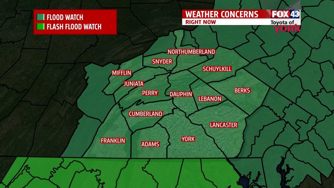
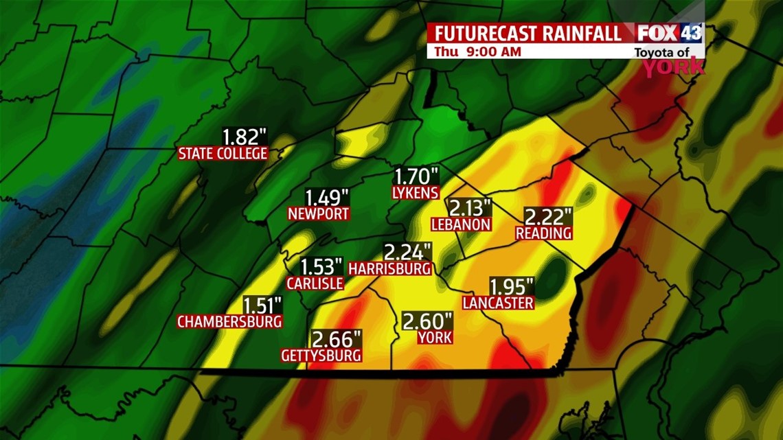
…A FLOOD WATCH is in effect through Thursday morning. Steady rain, heavy at times, will result in flooding of poor drainage areas as well as some of the creeks and streams…

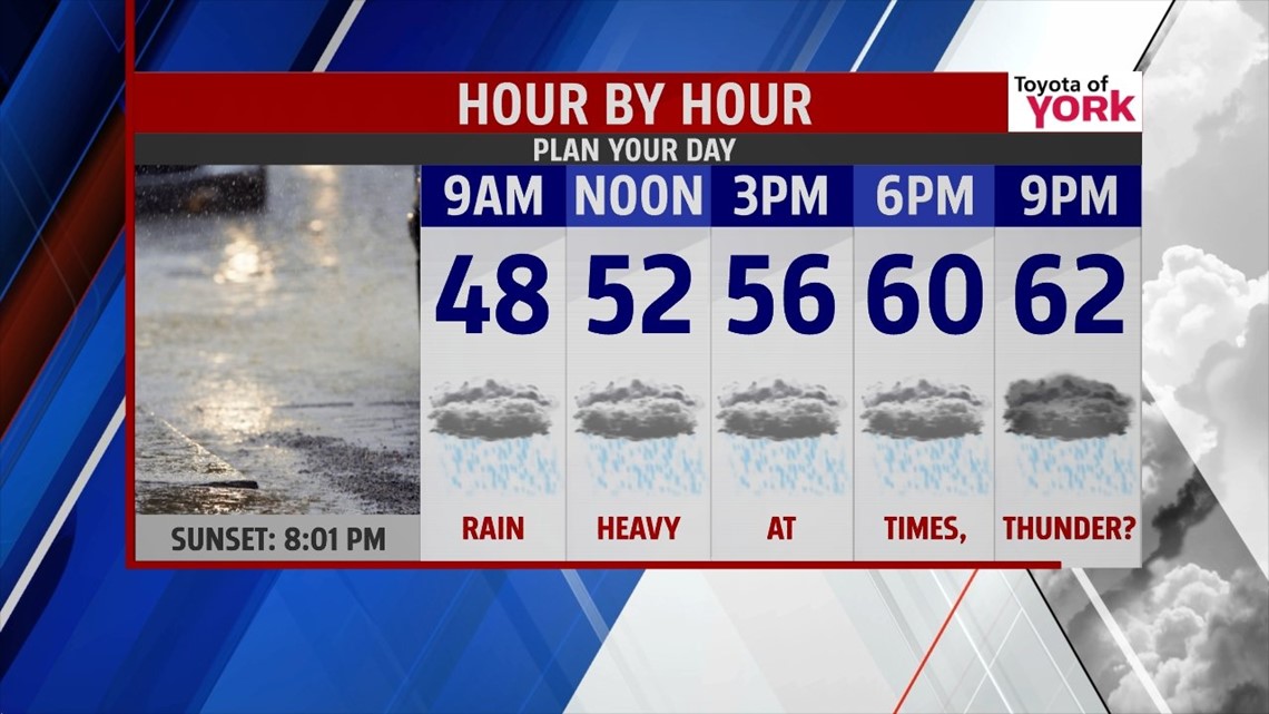
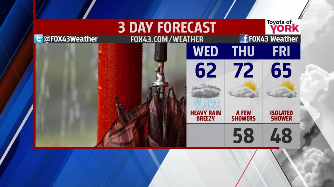
MORE RAIN: We’re in for another day of breezy, cool showers today. Rain is likely today, with batches of heavier showers and maybe a few rumbles expected later in the day. A slowly advancing warm front will make our temperature rise very slow. We’re in the mid 50s this afternoon and near 60° by midnight, with the warmest air along the PA/MD border. This front, along with a cold front right behind it, provides the needed lift for the heavy rain showers. We’re expecting storm total amounts to reach the 3-4” range with isolated higher amounts. Severe weather at this time looks to stay just south of the border, but some storms could contain some gusty winds.


DRYING A BIT: We’ll see a delay in any cooler air trying to slip in for Thursday. With partly cloudy skies and leftover energy, we may see a few showers or thunderstorms bubble during the day. Highs are in the low to middle 70s.
By Friday, the cooler air catches up to us. Highs will be in the middle 60s with partly cloudy skies again. A breeze will help add to the cool feel. We may see a stray shower.

WEEKEND: Another wave comes in on Saturday, but it’s weaker and faster. Expect highs in the middle 60s with mostly cloudy skies and scattered showers. By Sunday, the skies scour out the clouds with only a leftover shower or two possible. Highs will stay in the middle 60s.
NEXT WEEK: We start dry, but we sit on the storm track, so expect some fast moving shots of precip through the week. It looks seasonal, with highs remaining in the 60s for now.
Have a wonderful Wednesday. Avoid flooded roadways. TURN AROUND, DON’T DROWN.
“Fall seven times. Stand up eight.” – Japanese Proverb
– Jeff Jumper, WPMT FOX43 Morning Meteorologist
Follow me on Twitter: @JeffJumperWX
Like me on Facebook: Jeff Jumper FOX43