

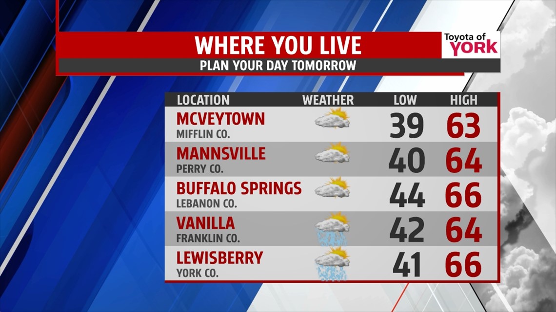
DRYING OUT AND CLEARING

Spotty showers continue through the late day hours, but they begin to dwindle this evening. The clouds break apart too through the night and the breezy winds die down. It’s dry as well lasting through the overnight period but a bit on the chilly side. Overnight lows fall into the upper 30s through middle 40s across our region. Overall, it’s a quiet night.
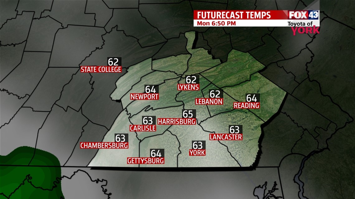
MAINLY DRY EARLY WEEK
A front sits just to our southwest for the beginning of next week, keeping us on the cooler side. Temperatures are near or just below seasonable averages Monday through Wednesday. Expect sunshine to get mixed with clouds at times, and a stray shower or two could sneak in, especially to the southwestern parts of the area on Monday and Wednesday.
WARMING UP!
Thursday the front begins to slide north as a warm front, increasing clouds and bringing a better chance for some showers. A thunderstorm is also possible. Highs jump into the 70s, and continue to climb into Friday. The front is completely north of us by then, ushering in some unseasonably warm air. Highs are near 80 degrees. Saturday a cold front approaches the region, bringing the chance for showers and thunderstorms. High temperatures will still reach the 70s. Sunday remains unsettled with temperatures near our seasonal averages for this time of year.
Have a great week!
-Andrea Michaels