
OVERVIEW: A warm front will slowly move across the area through the day tomorrow. It will keep the clouds and isolated shower chance around for the day. It will also begin to boost our temperatures, especially Friday where they could reach 80 degrees in some spots, once it is north of us. Our next best shot at rain will arrive Saturday ahead of a cold front which moves south of the area by early Sunday morning. Any showers on Mother’s Day will be very early so much of the day looks to remain dry. The cold front will return late Monday as a warm front trigger more showers heading into Tuesday.

EVENING FORECAST: A blah kind of evening with plentiful cloud cover and hit or miss showers. Temperatures will fall from the low 60s to the middle 50s.
OVERNIGHT: Mainly cloudy skies and because of the clouds, lows will be milder in the low 50s. Can’t rule out an isolated shower especially towards the early morning hours.
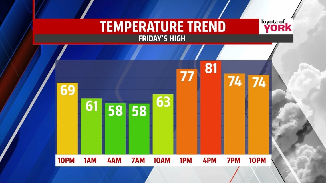
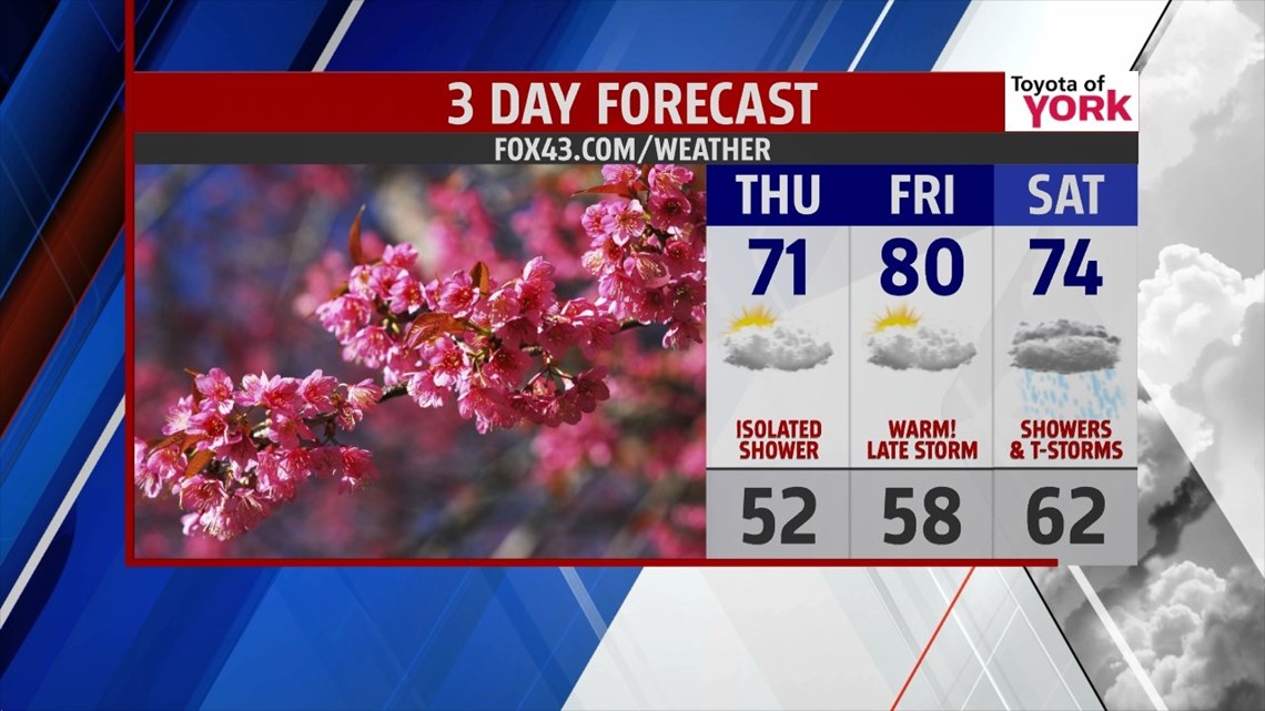
END OF THE WEEK: Thursday may start with a few isolated showers and clouds but more sunshine mixes in through the afternoon. Highs will be tricky as the warm front will be a slow mover. Parts of the area north and east could remain in the upper 60s to low 70s, in and around Harrisburg could warm to the middle 70s while south and west where the front moves north could see temps flirt with the upper 70s. Tough call. By Friday, with the front north of us and the winds more southerly, we should much of the area in the upper 70s to near 80 degrees with a few spots even warmer. Only an isolated chance for a shower or thunderstorm is possible in the afternoon

WEEKEND OUTLOOK: Next front coming in from the Ohio Valley will bring a return threat of wet weather overnight Friday into the start of the weekend. Showers will be likely for Saturday. With the clouds and showers around, highs will be in the mid 70s. Sunday models are split on our rain chances so for now we’ll call it just an isolated chance for Mother’s Day and mainly in the early morning hours but of course we will keep you updated through the week. Highs will run in the 70s.

EARLY NEXT WEEK: Warm front approaches late Monday trigger our next chance for showers. Most of the day remains dry and warmer with highs in the mid to upper 70s. By Tuesday, our rain chances ramp up with the passage of a cold front. Temperatures will cool off behind the front to more seasonal averages Wednesday under mostly sunny skies.
Have a nice week everyone!
MaryEllen Pann, Chief Meteorologist
Like me on Facebook: maryellenpannfox43
Follow me on Twitter: @MaryEllenFox43