

WARM & MUGGY
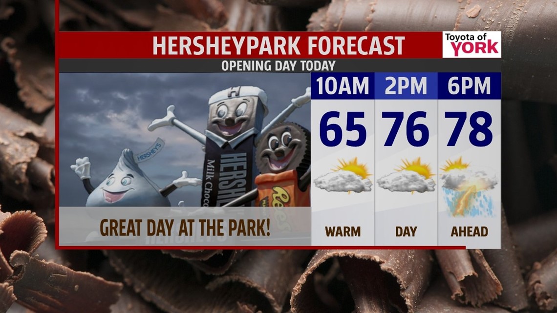
Expect a foggy and misty start across the Lower Susquehanna River Valley Friday. Once the strong sunshine breaks up the fog, temperatures are quick to warm out of the 60s and through the 70s. An advancing cold front from the west spills clouds into the area during the afternoon hours. A couple thunderstorms are possible too, especially west late in the day. Afternoon highs are in the upper 70s to lower 80s! A few thunderstorms become more likely during the evening hours. Then, showers and thunderstorms overspread through the night. It’s warm and muggy with foggy areas once again. Lows are in the 60s.
50/50 WEEKEND

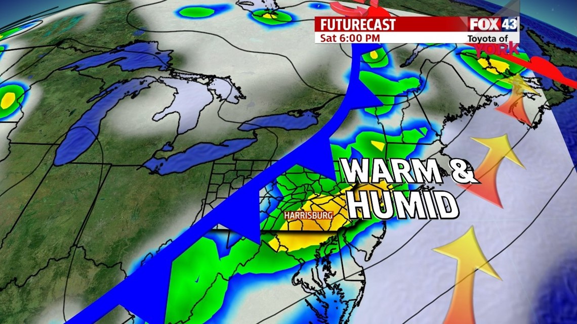
The cold front is slow to move across the region, keeping widespread showers and thunderstorms in the forecast for Saturday. Temperatures are still on the warmer side. Afternoon highs reach the middle 70s. The humid feel is still around too. By Sunday, the cold front is gone, bringing a return to the sunshine. We stay warm, however, with high temperatures up near 80 degrees again!
STAYING WARM & UNSETTLED
The warmth is here to stay for some time! A strong southwest flow establishes itself over the area early next week, boosting temperatures into the lower 80s on Monday. The humidity returns too. There is a chance for a few stray thunderstorms, but most should be dry. A late day thunderstorm chance is expect Tuesday ahead of our next cold front. More widespread showers and thunderstorms are expected Wednesday as the cold front slowly slides through. Highs are in the lower to middle 80s and fall into the 70s Wednesday. Thursday, the front could linger early in the day, keeping a shower chance before skies clear out.
Have a great weekend!
-Andrea Michaels/Jeff Jumper