

COOL & COMFY NIGHT
After a nice and warm day, the overnight period looks just as great! Expect a mixture of clouds and clear skies through the night. Temperatures quickly fall out of the 70s, bottoming out in the middle to upper 50s. The humidity stays low, so it’s very comfortable. It’s a perfect night to crack open the windows!
TURNING EVEN WARMER

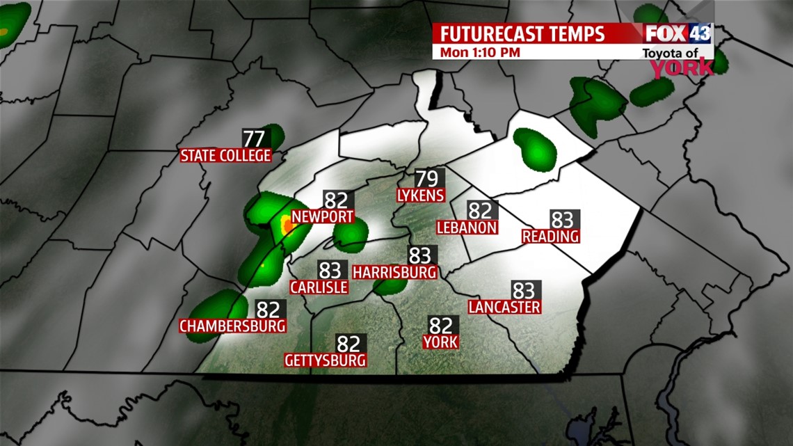
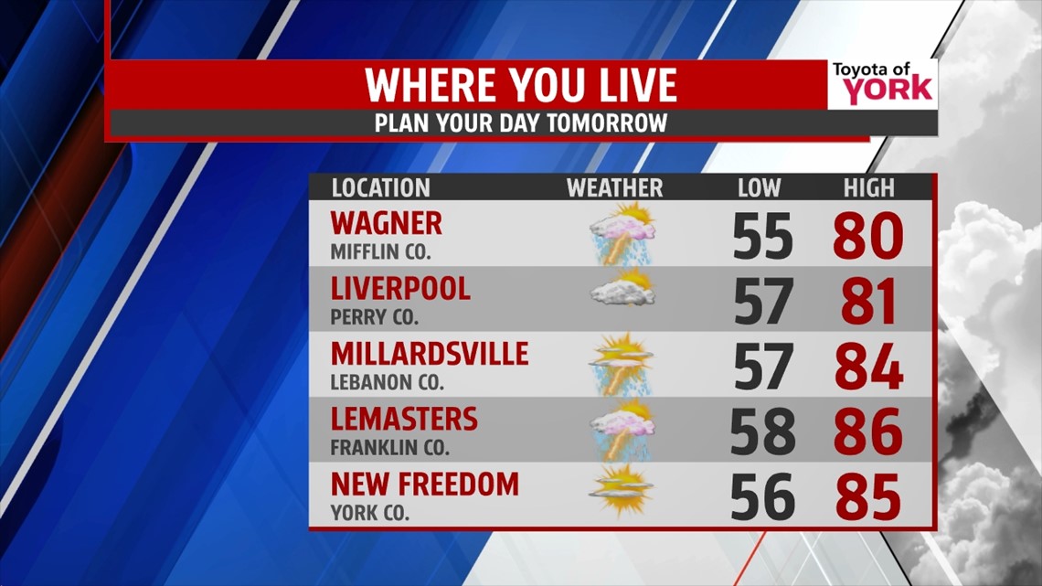
The warmth is here to stay for some time! In fact, temperatures continue to climb. A strong southwest flow establishes itself over the area for the start of the workweek, boosting temperatures into the lower to middle 80s on Monday. The humidity returns too. There is a chance for a few stray thunderstorms, but most should be dry. A late day thunderstorm chance is expected Tuesday as well ahead of our next cold front. Highs reach the middle 80s.
MORE T’STORM CHANCES
The cold front slowly creeps closer, so we can still see a few thunderstorms pop up Wednesday. Highs fall into the lower to middle 70s Wednesday as some cool air from the northeast tries to slip in. Thursday into Friday, the cold front crosses through the region, bringing widespread showers and thunderstorms. By Saturday, skies look to dry out, and some much cooler air works into the region. Sunday a few showers are possible. Highs are in the upper 60s through the weekend.
Have a great week!
-Andrea Michaels