
OVERVIEW: Warm front progresses towards us tonight and tomorrow bringing our best threat for showers and thunderstorms. It will also keep our temperatures at or above seasonal averages before a cold front brings cooler air to end the week. While showers will be possible Thursday and Friday, chances remain isolated. Heading into the weekend, the trend will be for temperatures to warm up especially for the Memorial Day holiday!
EVENING FORECAST: There could be a few spotty sprinkles or isolated shower this evening otherwise, mostly cloudy with temps falling from the low 70s to the lower 60s.
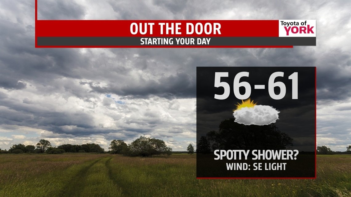
OVERNIGHT: Chance for a few showers, otherwise, mostly cloudy. A few isolated morning showers possible but most will remain dry for the morning commute. Lows will be milder in the mid 50s to around 60 degrees.

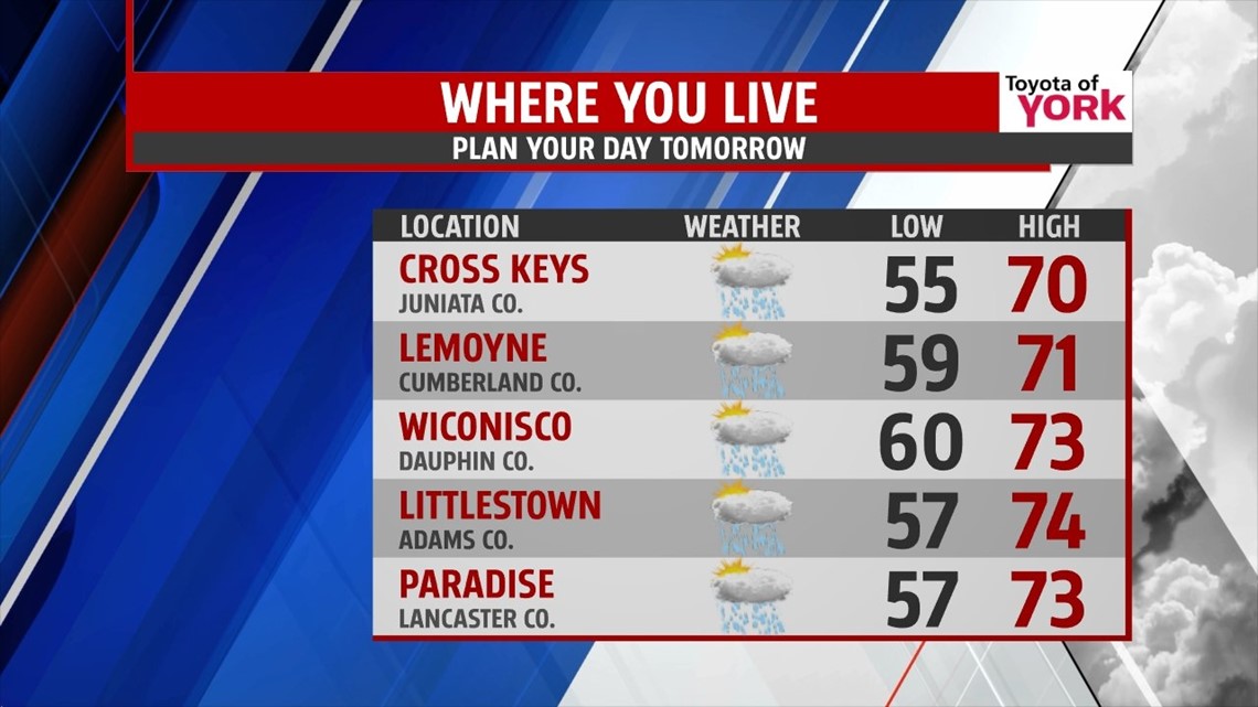
WEDNESDAY: Scattered showers and a few rumbles of thunder will be possible especially in the afternoon. Expect temperatures to warm to the low 70s.

END OF THE WEEK: Upper level trough starts to dig back in Thursday. With upper level impulses riding through the base, we could see a few isolated showers each day. Certainly plenty of dry hours as there will not be a lot of moisture to work with. Highs will reach the middle 70s Thursday then fall back following the cold front for Friday to near 70.
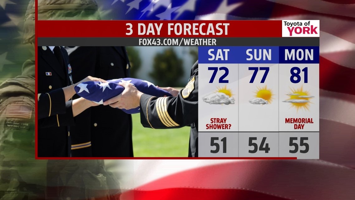
HOLIDAY WEEKEND OUTLOOK: Trough loses grip over the northeast as a ridge of high pressure starts to build in. Highs will warm to the low 70s Saturday with partly sunny skies and maybe a few stray showers, however, we see temperatures really warm Sunday to the mid and upper 70s and even warmer Monday for the Memorial Day holiday to 80 degrees under plenty of sunshine! Tuesday highs will soar to the mid 80s under partly cloudy skies. Later in the day a few showers and thunderstorms may bubble up but at this point most of the looks dry.

Have a good week!!!
MaryEllen Pann, Chief Meteorologist
Like me on Facebook: maryellenpannfox43
Follow me on Twitter: @MaryEllenFox43