
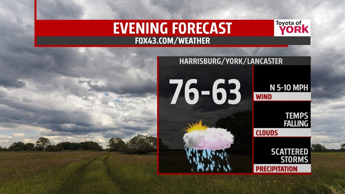
THIS EVENING: Early in the evening our shower and storm threat diminishes as a cold front sags to the south leaving cloudy skies for much of the evening. Temperatures will fall from around 80 degrees to the upper 60s by 10pm.

OVERNIGHT: Easterly, cool flow will lower the clouds and result in areas of fog and drizzle. Temperatures will be much lower than the past few mornings in the low to mid 50s.
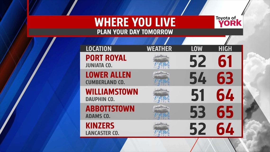
TOMORROW: Cloudy skies will rule the day as the east wind continues. There may be a few pockets of drizzle and showers which will help to keep temperatures locked in the low 60s.

OUTLOOK: Friday afternoon our next cold front approaches and may trigger an isolated shower or thunderstorm. Most of the rain threat remains to our north. High pressure builds in for the weekend bringing plenty of sunshine and dry hours for Saturday and Sunday. Highs will be in the upper 70s. Monday looks to be mostly dry until the evening when a few storms will be possible after heating up into the low 80s. A cold front Will continue the storm threat for Tuesday and Wednesday with temperatures much warmer in the middle 80s.
Have a nice week!
MaryEllen Pann, Chief Meteorologist
Like me on Facebook: maryellenpannfox43
Follow me on Twitter: @MaryEllenFox43