

OVERNIGHT: Showers and storms initially during the evening will end as a cold front dives to the south. Skies will gradually clear some overnight and humidity will be dropping. A dry, quiet night is in store for us with lows in the low 60s.

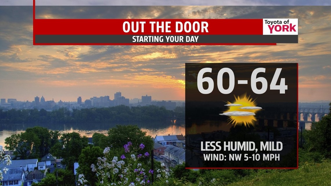
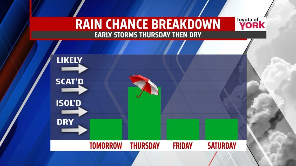
TOMORROW: High pressure builds in briefly bringing a more comfortable day with sunshine to start. Clouds will be increasing as a strong area of low pressure rides in from the Ohio Valley tomorrow night into Thursday morning. Highs will be warm in the low 80s but with dewpoints back in the 50s, it will feel less humid and more comfortable.

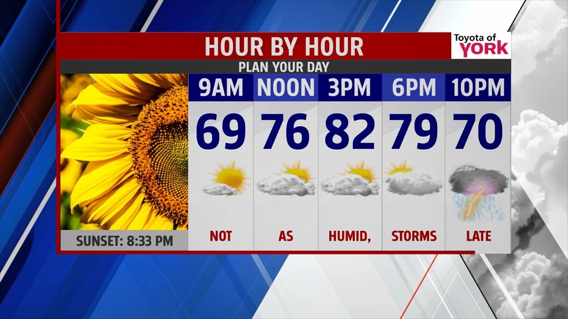
OUTLOOK: A strong wave of low pressure, along with a Mesoscale Convective System or complex of thunderstorms, moves in tomorrow night into Thursday and may dump heavy rain in places. Right now it looks as if the severe weather will target areas to our south across MD and VA. The rain threat should move out by the afternoon Thursday as high pressure returns. Highs will be cooler and a tad below average in the upper 70s. Skies will clear and we will see a very nice end to the week. Friday and the start of the weekend looks dry and fabulous! Temperatures look to end the week close to seasonal averages in the upper 70s to near 80 Friday to low 80s Saturday and Sunday. Next front comes in Monday. We could see a late night storm as early as Sunday but the best chance will be Monday with highs in the upper 70s to near 80. Tuesday looks sunny and dry with temperatures in the low 80s.
MaryEllen Pann, Chief Meteorologist
Like me on Facebook: maryellenpannfox43
Follow me on Twitter: @MaryEllenFox43