

HUMIDITY & STORMS CONTINUE

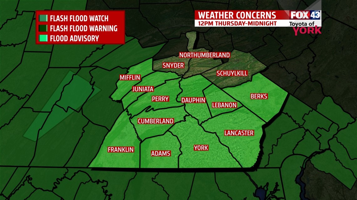
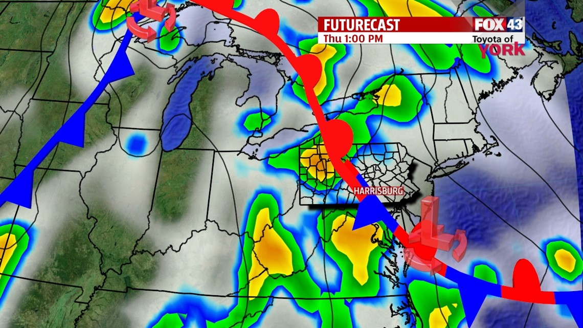
More widespread showers and thunderstorms have entered the picture, courtesy of a weakening cold front. This keeps us unsettled through the end of the workweek. With this in mind, expect to be dodging showers through the morning commute. An easterly wind has lowered the humidity levels a touch, but it will begin to feel muggy again into the afternoon hours. More showers and even a few thunderstorms are expected into the afternoon hours, so be sure not to leave home without the umbrella! Some locally heavy downpours are likely too. In fact, the National Weather Service in State College, PA has issued a Flash Flood Watch for our area, beginning at noon Thursday and lasting through midnight. Highs are in the middle 70s due to the clouds and rain. Another cold front swings through Friday, renewing the shower and thunderstorm chance. Highs are in the middle to upper 70s.
TEMPORARY WEEKEND RELIEF
The cold front exits Friday night, bringing drier and more comfortable conditions just in time for Father’s Day weekend. Expect lower humidity levels. There’s plenty of sunshine both Saturday and Sunday. Highs are near 80 degrees Saturday and in the lower 80s on Sunday.
WARMTH & HUMIDITY RETURN
Monday clouds begin to build again, along with the humidity. Our next storm system brings some afternoon showers and thunderstorms. Highs are in the middle 80s on Monday. Temperatures climb into the middle to upper 80s Tuesday and Wednesday, with a few thunderstorms still possible.
Have a great Thursday!
-Andrea Michaels