
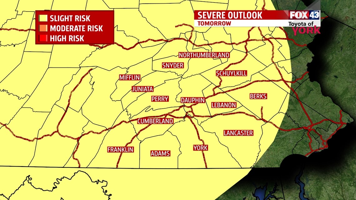
SLIGHT RISK FOR OUR AREA TOMORROW: The Storm Prediction Center has us highlight in a slight risk for severe storms on Wednesday. Damaging winds, hail and torrential downpours will be the main concerns. Best chance for storms to erupt will be in the afternoon and evening so you need to keep an eye to the sky if you are planning on being outdoors in the pool, working around the yard or whatever the case may be. Stick with WPMT Fox43 Weather on Facebook, Twitter and Fox43.com for the latest on threatening weather.

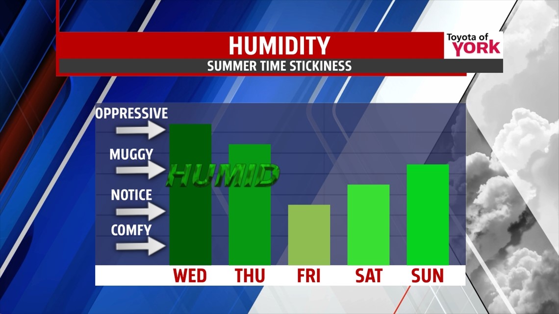
THIS EVENING: It will remain very warm and sticky humid this evening. Temperatures will drop through the 80s to the upper 70s tonight. There is an isolated threat for storms some of which may produce torrential downpours and gusty strong winds. As of now, the severe threat remains to our north but if that changes will bring you up to date.
OVERNIGHT: We’ll watch a developing line of storms expected to drop out of the Great Lakes and move southeast. If they hold together, we could have a few storms around for the early morning hours and some of them could be accompanied by strong damaging winds. Lows in the morning will be very warm in the upper 60s to low 70s.


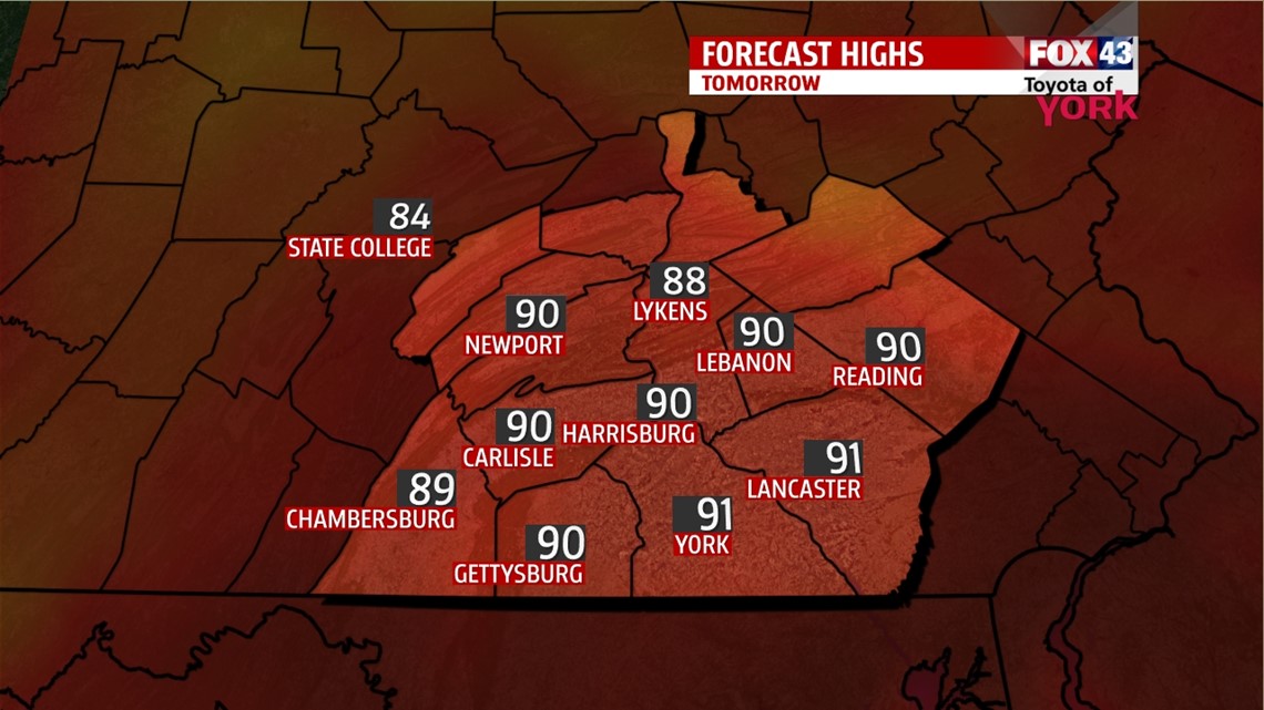
TOMORROW: A cold front continues to approach into a very warm and humid air mass. We will see showers and thunderstorms develop late in the day and evening and some of the storms may be severe with damaging winds the main concern. Highs will again warm to the upper 80s to low 90s. Heat index values will run in the low to mid 90s.

OUTLOOK: The front slowly sags through the area Thursday keeping scattered showers and storms in the forecast. With the front finally moving into Maryland by late afternoon, our storm chances will diminish and temperatures will be several degrees cooler in the low to mid 80s. It will take a little longer for the drier air to filter in so it will still feel humid for much of the day. We get a break from the humidity and storms on Friday but not for long as our storm chances increase into the weekend and it starts to feel stick again as the same boundary moves back north as a warm front. Storm threat hangs on into early next week as the next frontal system stalls in the area. Temperatures will be hovering in the low to mid 80s.

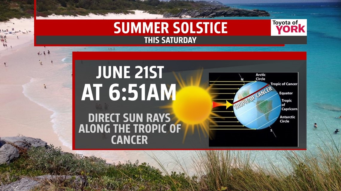
SUMMER OFFICIALLY ARRIVES THIS SATURDAY!

MaryEllen Pann, Chief Meteorologist
Like me on Facebook: maryellenpannfox43
Follow me on Twitter: @MaryEllenFox43