
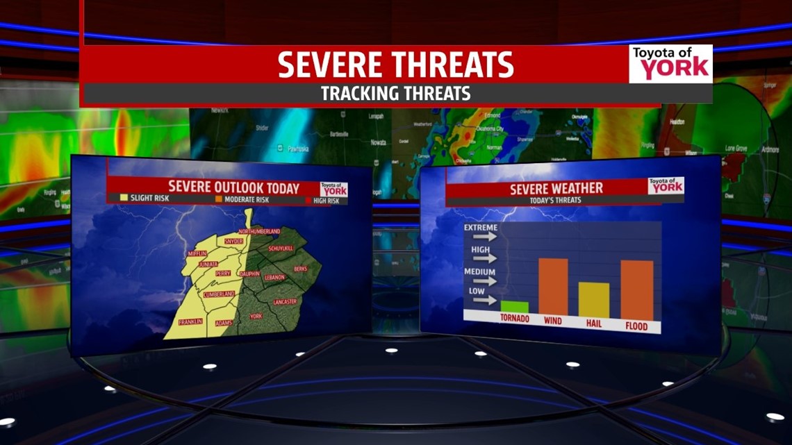
SLIGHT RISK FOR SEVERE STORMS FOR COUNTIES FURTHER WEST. Damaging wind, hail, frequent cloud to ground lightning and very heavy rain will be possible with the storms.

THIS EVENING: Very warm and muggy conditions and an approaching cold front will help to trigger a few showers and thunderstorms. Some of which may be strong to severe. Temperatures will fall from around 90 to the low 80s this evening and it remains muggy.
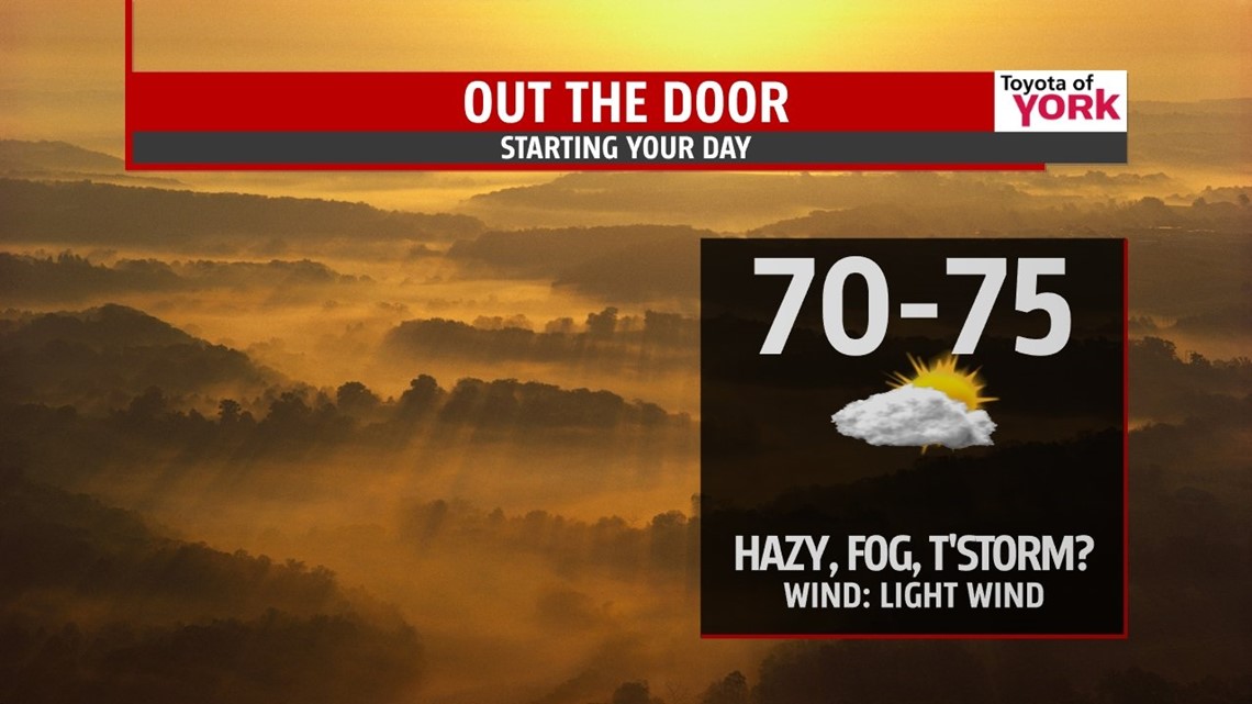
OVERNIGHT: Partly cloudy skies, a stray shower or thunderstorm is possible but most of the area remains dry. Expect it to be muggy and very sticky with hazy conditions by morning which may be accompanied by patchy fog. Lows will be above average and warm in the low to mid 70s.

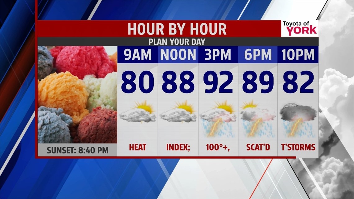
TOMORROW: Cold front moves further east across our area triggering scattered showers and storms especially in the afternoon and evening. The STORM PREDICTION CENTER has our entire area in a SLIGHT RISK for severe storms. Damaging winds, hail, frequent lightning and very heavy rain will be likely. Highs will be hot reaching the low to mid 90s but the Heat Index will run in the low 100’s.

OUTLOOK: Second front and upper level trough swings through Thursday keeping the showers and storms around through much of the day and some of the wet weather may linger into early Friday morning. Highs Thursday will still be warm in the upper 80s and the humidity will be high but should be on the decline as somewhat cooler, drier air funnels in for the holiday weekend. Fourth of the July looks to be dry right now but we are watching the track of our first tropical storm of the season. Tropical Storm Arthur is situated off the southeast coast of Florida and is forecasted to track right along the shoreline towards the northeast. As it moves up the coast, it will bring showers and storms along the beaches from the Carolina’s to Virginia and Maryland. It does not appear this far inland the storm will have any impact on our Independence Day celebrations. The upper level trough and cold front on Thursday should help to steer the low pressure system away from us. Big bubble of high pressure settles overhead to bring another fabulous weekend to us with plenty of sunshine, lower humidity and highs near seasonal averages in the low to mid 80s
MaryEllen Pann, Chief Meteorologist
Like me on Facebook: maryellenpannfox43
Follow me on Twitter: @MaryEllenFox43