
THE STORM PREDICTION CENTER HAS PLACED OUR AREA IN A SLIGHT RISK FOR SEVERE STORMS TOMORROW.

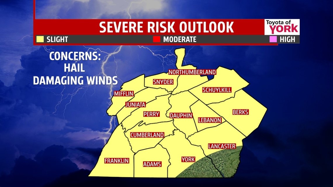
THIS EVENING: A weakening front is pushing in from the west. Winds have picked up out of the southwest which is helping to pull in more moisture so expect it to be a muggy, warm evening with temperatures slowly falling though the 80s. Isolated storms are possible with the best chance being north and west of Harrisburg. Those that do develop may be strong to severe with damaging winds and hail being the main threats. South and east of Harrisburg should remain mostly dry, just humid and warm with partly sunny skies expected.

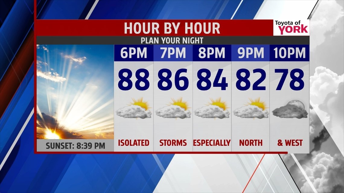
OVERNIGHT: Muggies will be back with partly cloudy to hazy skies. Lows will be warm in the upper 60s to low 70s.
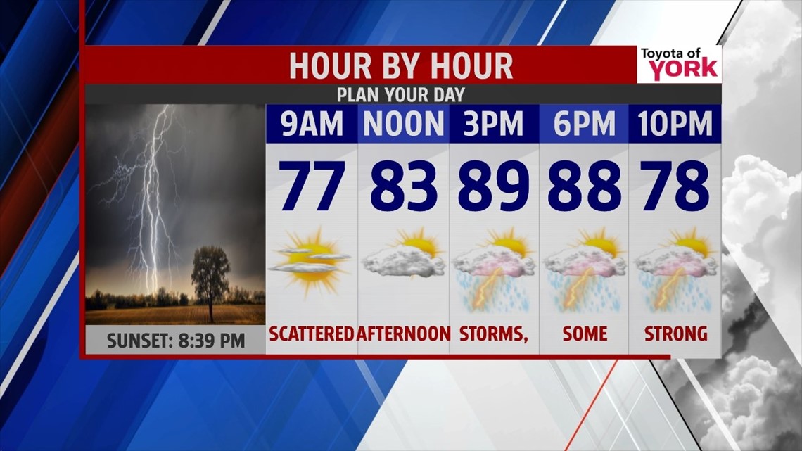
TOMORROW: As a stronger cold front advances and the day heats up, strong to severe storms are possible for much of the area by afternoon. The main concern will be for damaging winds, hail and heavy downpours. It will be very warm and humid with highs in the upper 80s to near 90.

OUTLOOK: Front pushes through early Wednesday so there could be still a few showers and storms that pop up until the front clears the area. They will be few and far so much of the area will remain dry. The humidity will be slow to improve and highs should be near average in the mid 80s. High pressure builds in for Thursday and Friday bringing a couple of dry days with highs in the low to mid 80s. Looks like our string of nice and rain free weekends comes to an end although it won’t be a washout by any means. Saturday looks to be mostly dry with only an isolated storm threat. Highs will warm to the mid 80s but Sunday with the next front approaching, shower and storm chances go up and so does the humidity. Highs will be warmer too in the upper 80s. Monday it looks like the storm threat continues until the front passes. It will be a warm and humid start to the week with highs near 90.
MaryEllen Pann, Chief Meteorologist
Like me on Facebook: maryellenpannfox43
Follow me on Twitter: @MaryEllenFox43