
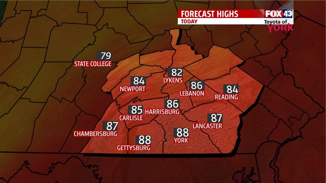
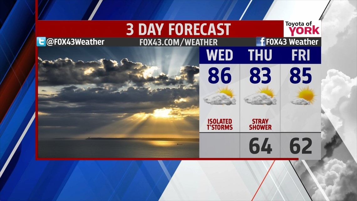
TRANSITION: After a very rocky Tuesday, we begin our transition today with lower heat and humidity and a few leftover showers and storms along a passing cold front. Expect partly cloudy skies with highs in the middle 80s and more manageable humidity. Tonight, we’re down to the middle 60s.

COMFY: High pressure helps to keep us mainly dry and seasonably warm for the latter half of this week. Highs Thursday are in the low to middle 80s with lower humidity and partly cloudy skies with only a small shower chance. Friday, wit’s mostly sunny with highs in the middle to upper 80s. The humidity stays in check again.

WEEKEND: We warm again with humidity slowly on the rise for the weekend. Saturday, we’re in the middle 80s. It’s mostly sunny and looks mostly dry. Sunday, a wave approaches adding clouds and increasing storm chances, especially late. Highs are in the upper 80s.
NEXT WEEK: Storms chances linger into Monday as our next storm system moves through. It’s seasonably warm and muggy again with a break in the action for Tuesday.
Make it a wonderful Wednesday!
“I’m not upset that you lied to me, I’m upset that from now on I can’t believe you.” – Friedrich Nietzsche
– Jeff Jumper, WPMT FOX43 Morning Meteorologist
Follow me on Twitter: @JeffJumperWX
Like me on Facebook: Jeff Jumper FOX43