
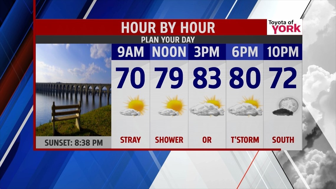
THIS EVENING: There is a chance for isolated showers and storms. Not everyone will see them but those that do could deal with strong to perhaps even a severe thunderstorm. The Storm Prediction Center has us under a light risk for storms that develop to possibly become severe. Main threat will be damaging winds and hail. We will not have anything like last night but storms still need to be watched as they could get feisty. All activity should diminish after sunset. A cold front coming into a warm and humid airmass will be the trigger for the storms. It will also be followed by drier and cooler air for the overnight period. Temperatures will drop through the 80s into the 70s. Breezy winds will die down later in the overnight period.

OVERNIGHT: Much more comfortable and cooler with lows back into the low to mid 60s. Clouds will clear out some leaving partly to mostly clear skies into the morning hours.


TOMORROW: High pressure builds in from the north tomorrow and provides a mainly dry day. However, further to the south the cold front gets hung up across the Mid-Atlantic. This means our southern counties still have a small chance of seeing a shower or thunderstorm develop in the afternoon. Chance is very isolated and mainly along the Maryland Line. Highs will be cooler in the low 80s with very comfortable conditions.

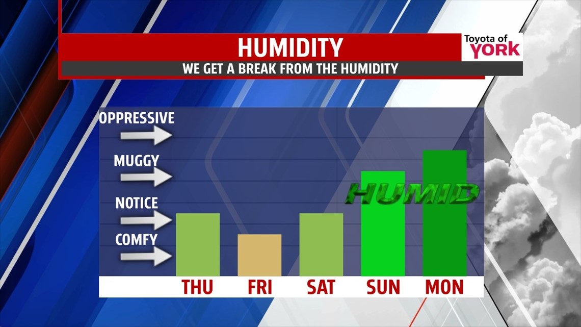
OUTLOOK: We are quiet and dry Friday and Saturday with plenty of sunshine. Highs will be in the mid 80s. The high pressure system slips off the coast setting up a return flow which will bring in more moisture and warmer air. The next system approaches Sunday. It will be warmer and more humid with highs in the upper 80s. Storm chances return as well and continue into early next week. Upper level trough will dig in by Wednesday really cooling off our temperatures and bringing fairly quiet weather. Timing of frontal passage and trough moving in is still a big question mark since the modeling is not agreeing. We’ll update the forecast as we get better information in the upcoming days.
MaryEllen Pann, Chief Meteorologist
Like me on Facebook: maryellenpannfox43
Follow me on Twitter: @MaryEllenFox43