
THIS EVENING: Wow, it is super nice out. It is feeling cooler and much drier with dewpoints back into the 50s. Temperatures will fall from the upper 70s to the mid 60s.
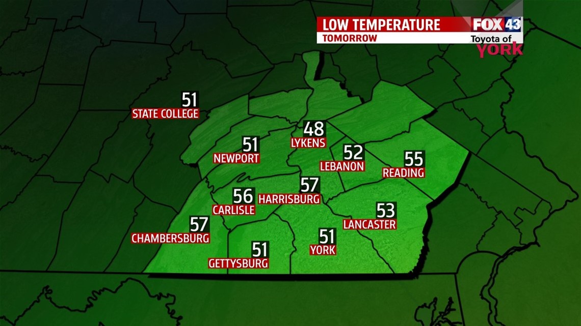
MORNING: Bright sunshine to start the day but more importantly are the cool morning lows expected to blanket the area. We’ll hit the mid 50s.

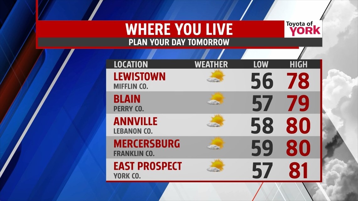
TOMORROW: High pressure brings a nice end to the week. Highs near 80 under mostly sunny skies and a light breeze.

OUTLOOK: We’ll start with sunshine Saturday but a warm front approaches and brings them back. It will also bring warmer temperatures along with a stray shower or thunderstorm. Highs should get back to the mid 80s. Sunday a strong cold front brings a chance for scattered showers and thunderstorms. With the front slowing and not pushing through until late Monday, the threat for showers and storms will continue for the start of the week. Highs Sunday will warm to the mid 80s while the cool down to the low 80s for Monday. A deepening, unseasonable like trough digs in for early next week leading to a cooler trend with temperatures remaining well below July averages. While the rain threat will be low, sunshine will mix with plenty of clouds for several days. It doesn’t look like the trough lifts out until later in the week. Highs Tuesday will be quite below average in the upper 70s and while it will be a few degrees warmer on Wednesday in the low 80s, it will remain unseasonable through much of the week.
MaryEllen Pann, Chief Meteorologist
Like me on Facebook: maryellenpannfox43
Follow me on Twitter: @MaryEllenFox43