
THIS EVENING: There will be a chance for few showers and thunderstorms but not a washout. Most will stay dry with mainly cloudy skies. Temperatures fall from the 70s to the upper 60s.
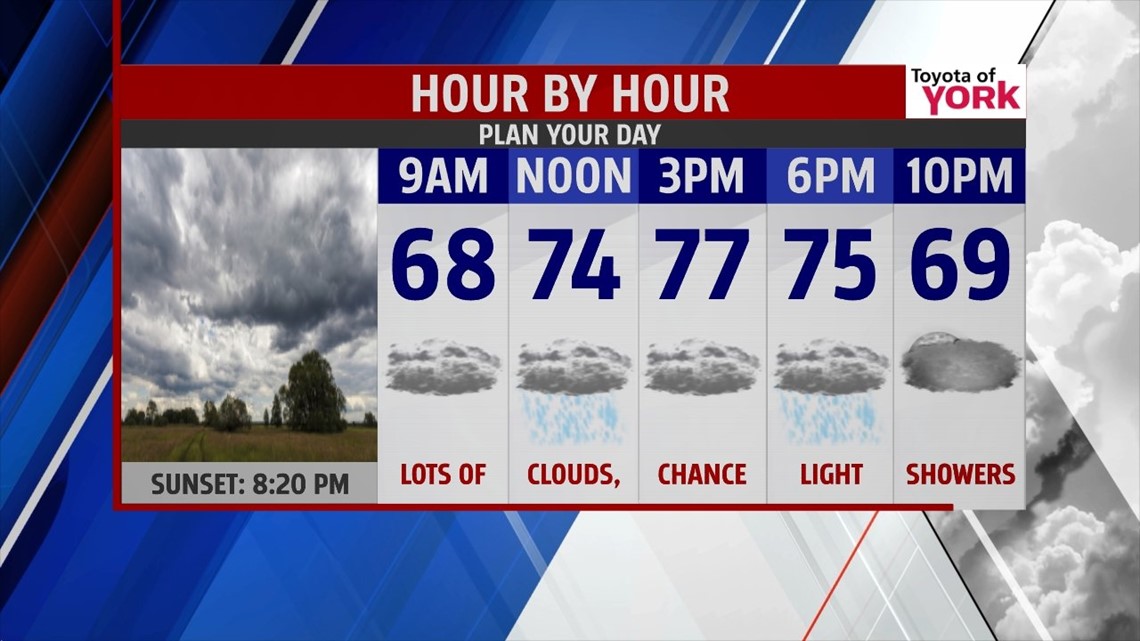
MORNING: Cloudy with fog, mist and haze. Few showers will be possible to start the day. We begin the day with temperatures in the low to mid 60s.


TOMORROW: Mainly cloudy with occasional showers and maybe a thunderstorm. Light rain is expected with the heaviest as of now remaining to our east. Highs will be kept in the 70s.

BEACH OUTLOOK: Not the best of beach weekends as it looks like heavy rain for the next two days with temperatures remaining in the 70s from the New Jersey coast down to Maryland.


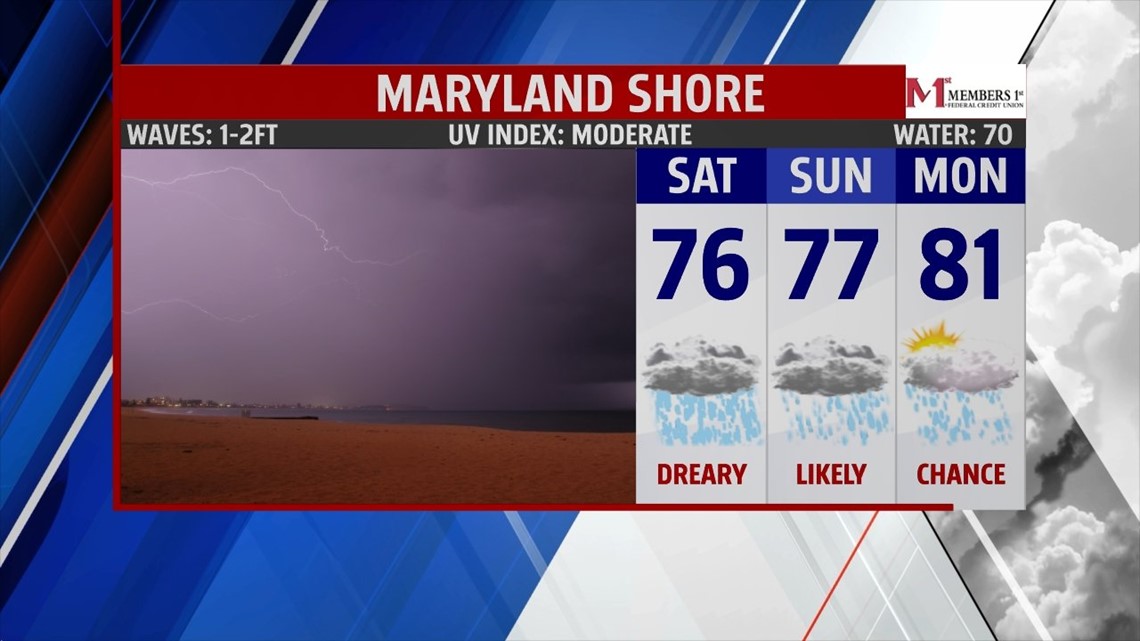
OUTLOOK: Frontal boundary off shore will hug the coast all weekend. Area of low pressure develops along it while riding up the coast. It will shift our winds to the east-northeast which means more clouds and the threat for on and off showers. Question will be where the heavy rain band sets up. Some models paint it closer to the Philadelphia area, others right across our area. We are leaning more towards the heaviest rain staying just east of us. Temperatures will be held in the 70’s do to the clouds and showers. Rain threat continues into Sunday with temperatures only rebounding slightly. You’ll notice the humidity a bit more. Early next week the upper level pattern relaxes and high pressure builds in at the surface allowing for temperatures to warm up closer to average in the mid to upper 80s. Rain chances will go down until a front comes in Wednesday producing the threat for a few showers or thunderstorms. Temperatures remain in the low 80s mid-week but warm back up Thursday.
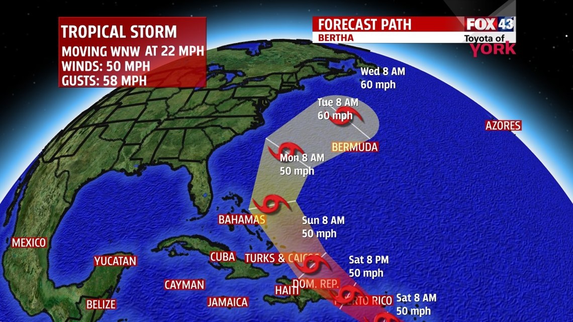
TROPIC UPDATE: The National Hurricane Center is tracking our second named storm of the season. Tropical Storm Bertha continues to move towards Puerto Rico then onto the Bahamas. As of now, it still looks like it will steer away from the coastline but may create some rough seas next week.

MaryEllen Pann, Chief Meteorologist
Like me on Facebook: maryellenpannfox43
Follow me on Twitter: @MaryEllenFox43