

MORNING: Clouds remain with us overnight, fog may form in spots as temps fall to the dewpoints and winds remain light. Lows will once again drop to the low to mid 60s. Can’t rule out an isolated in the morning shower.


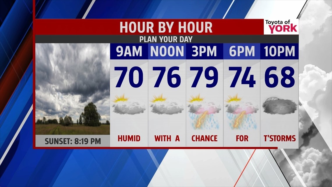
TOMORROW: Mostly cloudy with a chance for afternoon showers and thunderstorms. Not everyone will see them and those that do develop will have the ability to put down heavy rainfall. Highs will continue below average in the upper 70s to near 81.

OUTLOOK: Early next week the upper level pattern relaxes and high pressure builds in at the surface allowing for temperatures to warm up closer to average in the mid to upper 80s. Rain chances will be isolated until a front comes in Tuesday night into early Wednesday producing the threat for a few showers or thunderstorms. Temperatures remain in the low 80s through late week then start to warm up next weekend.
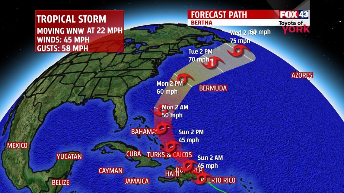
TROPIC UPDATE: The National Hurricane Center is tracking our second named storm of the season. Tropical Storm Bertha continues to cross over s Puerto Rico and will then move east of the Bahamas. As of now, it still looks like it will steer away from the coastline but may create some rough seas next week.

MaryEllen Pann, Chief Meteorologist
Like me on Facebook: maryellenpannfox43
Follow me on Twitter: @MaryEllenFox43