
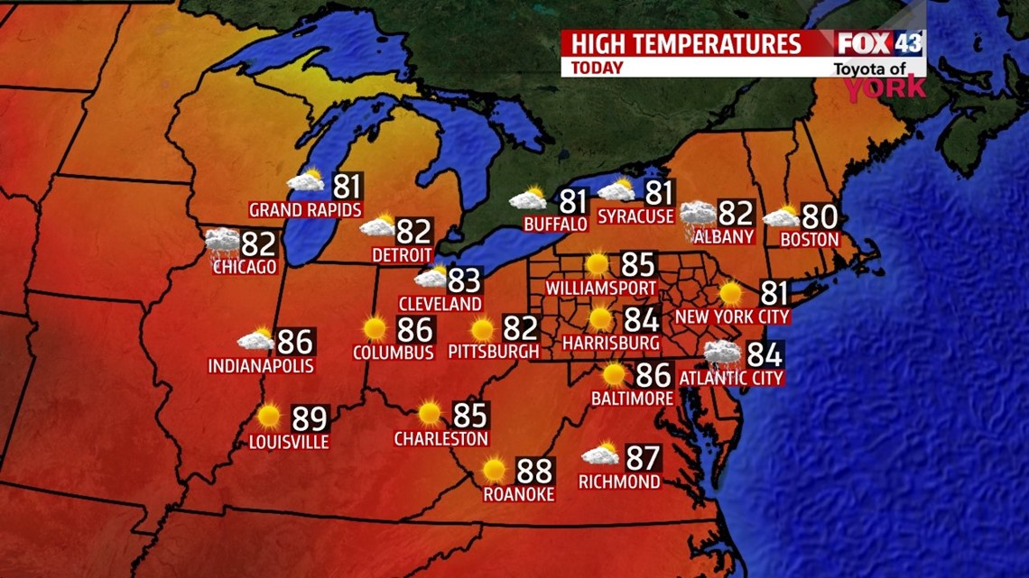
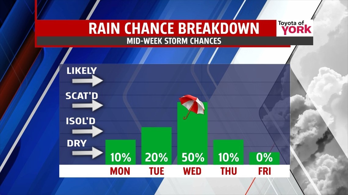
WARM START: The Sunday rain has ended and the morning begins foggy across the region for this Monday. High pressure is wedged between a system to our northwest and a stalled front out to sea. We’ll warm up with a return to seasonal averages and humidity. Expect mostly sunny skies later today with highs in the middle 80s. Tonight we’re mostly clear with patchy fog. Lows drop to the middle 60s. On Tuesday, highs top out in the upper 80s. There are a few more clouds and a small chance for some showers and thunderstorms.

FRONT: The cold front to our northwest finally glides through the state on Wednesday. It brings more clouds and a better shot at showers and thunderstorms. Highs are held in the low to middle 80s. Behind the front, high pressure settles in for us. This clears the skies, the heat, and the humidity. Highs will top out in the low 80s with mostly sunny skies to end the week.

WEEKEND: For now, it looks sunny, mild and dry. A storm system holds off to our south on the models thanks to high pressure holding steady across our area. Expect highs in the middle 80s with only a little bit of humidity. We’ll see mostly sunny skies. A small tweak in the setup could change things. We’ll watch it.
Have a great Monday!
“Happiness is not a goal…it’s a by-product of a life well lived.” – Eleanor Roosevelt
– Jeff Jumper, WPMT FOX43 Morning Meteorologist
Follow me on Twitter: @JeffJumperWX
Like me on Facebook: Jeff Jumper FOX43