

THIS EVENING: Finally a taste of summer today with seasonal temperatures. There could be isolated showers or thunderstorms later this evening. Temperatures will fall from the mid 80’s to the mid 70’s around 10pm.
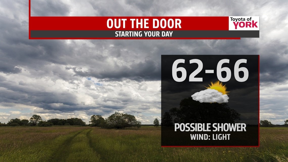
MORNING: There may be an isolated shower otherwise, partly sunny skies to start the day. Lows in the mid 60s.

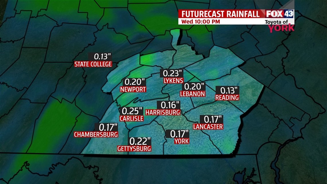
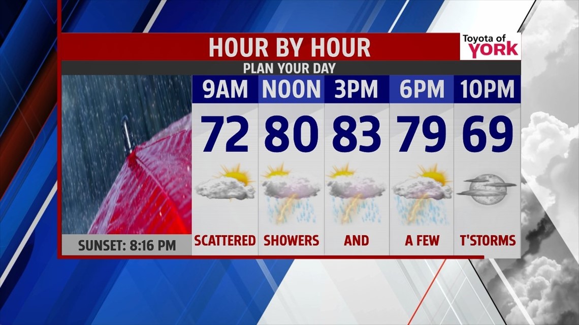
TOMORROW: Clouds will thicken and showers and possibly thunderstorms will be possible mid-morning into the afternoon. Any shower activity left over should be gone by the evening. Highs will be cooler in the low 80s.

OUTLOOK: Upper level trough digs in Thursday allowing for cooler, drier air to spill in. Highs will be in the upper 70s to low 80s with just a small stray shower for Thursday. We are on the back side of the trough along with more sunshine as high pressure strengthens at the surface for Friday. It will still be cooler with highs in the lower 80’s. Saturday the ridge builds over head and the surface high remains in control. Highs will range from the lower 80’s to the middle 80’s. The high is expected to jog eastward and with an area of low pressure diving to our south, the combination will set up an easterly flow. Clouds will increase late Saturday and remain through Monday. Right now there is some difference among the modeling on whether the low remains far enough south to avoid the rain. One model has showers arriving as early as Sunday and remains through Tuesday. For now we have kept the forecast dry until a cold front sweeps in late Tuesday.
MaryEllen Pann, Chief Meteorologist
Like me on Facebook: maryellenpannfox43
Follow me on Twitter: @MaryEllenFox43