


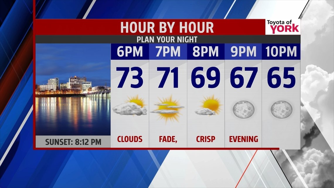
ANOTHER COOL NIGHT
A cool pool of air continues to slowly lift to the northeast, keeping cooler air settled over us through the night. High pressure is also working in conjunction to keep us dry. Through the evening hours, the clouds quickly crumble. It’s another cool evening, perfect for Friday night plans. The rest of the night remains cool with lows in the 50s, and a few locations falling into the upper 40s again.
50/50 WEEKEND

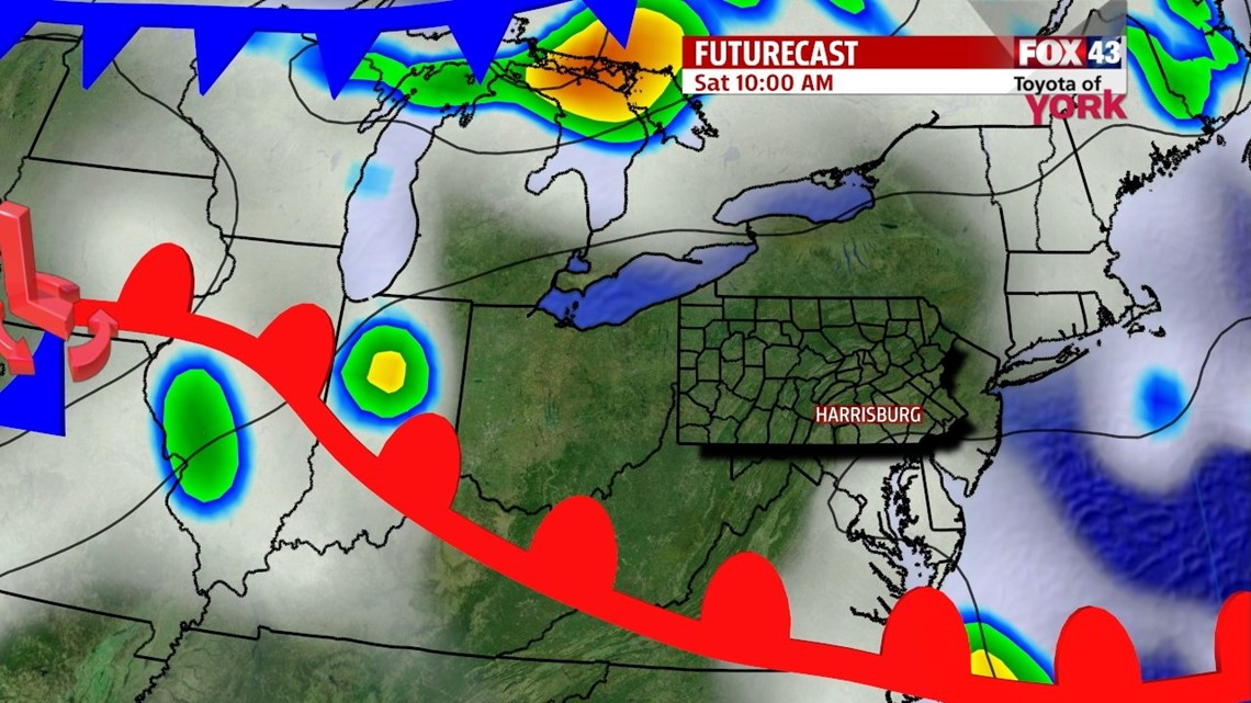
High pressure begins to weaken Saturday, but we’ll still experience another beautiful day. It’s also a little milder too. High temperatures are near 80 degrees, but many spots will still be stuck in the upper 70s. Sunday a cold front drops from the north. This brings more clouds and the chance for showers and thunderstorms. The humidity returns too. Highs are in the upper 70s to lower 80s.
T’STORM CHANCE CONTINUE
The front stalls just to the south of the area, and pieces of energy ride along it through the new workweek. This means there’s a daily thunderstorm chance next week, but there will be plenty of dry time too. Monday is the driest day, with only a small chance for an isolated thunderstorm. Tuesday and Wednesday, there’s the chance for a few thunderstorms. Thursday and Friday, there’s still a thunderstorm chance, and it looks a little more widespread than the first half of the work week. Highs hover near seasonable averages in the lower to middle 80s.
Have a great weekend!
-Andrea Michaels
