

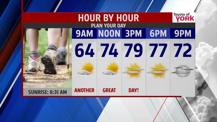

COOL END TO WORK WEEK

Canadian high pressure stays in control of our weather through the end of the work week, keeping us on the cool side. The clouds of the day quickly fade through the evening hours, and temperatures are quick to cool. Expect lows in the 50s under clear skies. The sunshine continues for Friday. Just some afternoon clouds move in. Temperatures stay a bit below seasonal averages Friday. Expect readings in the upper 70s to near 80 degrees.
LABOR DAY WEEKEND
On Saturday, temperatures should have no problem reaching the lower to middle 80s once the cooler air exits. Expect plenty of humidity to build, creating an uncomfortable feel. It’s a mainly dry day, but there’s the chance for a stray thunderstorm. Sunday a cold front brings the chance for afternoon scattered thunderstorms. Labor Day a few isolated thunderstorms are still possible. Temperatures are very warm and humid, in the middle to upper 80s.
STAYING WARM
Tuesday and Wednesday our next system approaches. This brings a better chance for thunderstorms with highs falling into the lower to middle 80s by Wednesday. Thursday, expect plenty of sunshine, with highs remaining in the middle 80s.
Have a great night!
-Andrea Michaels
