


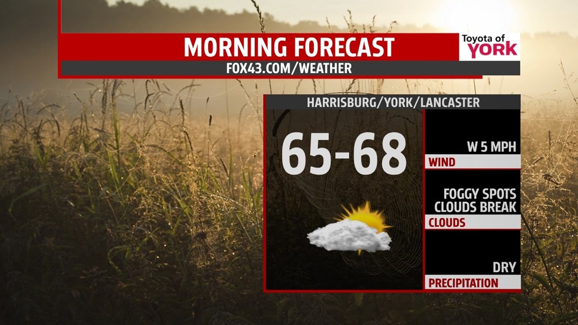
MORNING: Skies will be slow to clear and with the ground still moist from the storms, areas of fog will start the morning commute a bit on the slow side and limit visibility at times. Lows will range from the mid to upper 60s.

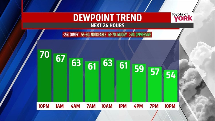
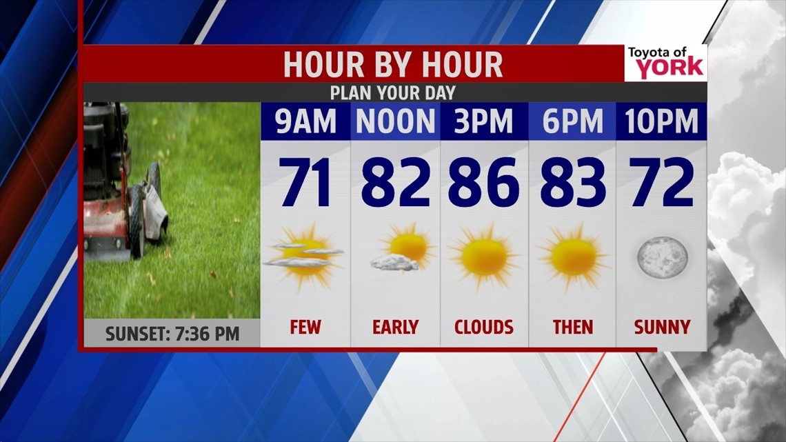
TOMORROW: Cold front will be south of us and high pressure builds in. While the dew points will drop as drier air funnels in, temperatures will remain warm and above average in the mid 80s. Once any fog burns off, skies will be sunny the rest of the day.

HSFF: Looks like there is only an isolated storm chance so most football games looking good for Friday. However, it will feel quite warm and the like the typical weather we like for the sport. You’ll feel the humidity more and temperatures are likely to be still in the low 80s around kick off. Cooling to the upper 70s once you are heading home.
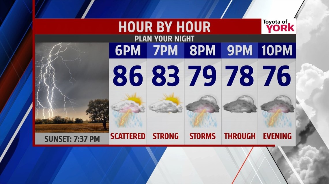
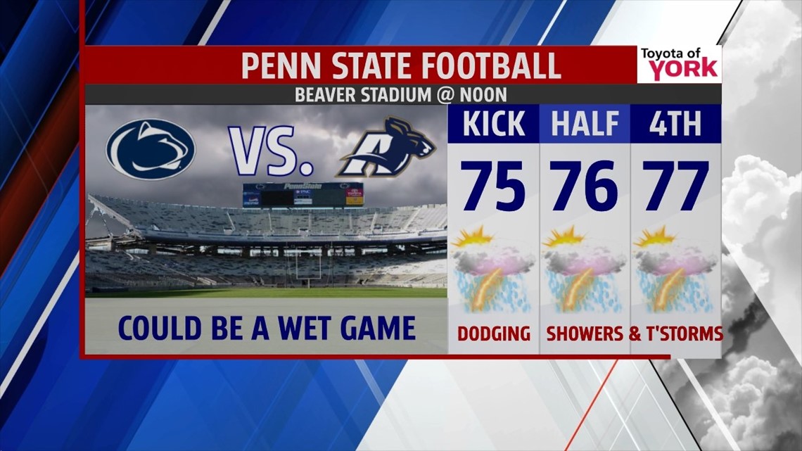
PENN STATE GAME: Looks like if you are heading to Beaver Stadium to watch the Nittany Lions take on Akron you may want to pack the rain gear. Scattered showers and thunderstorms will be possible for the day. Temperatures will hover and remain somewhat steady in the mid to upper 70s.

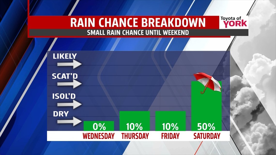
OUTLOOK: We’ll start the morning Thursday once again with areas of fog but once it burns off, skies will be sunny. Lows will range from the low to mid 60s but rebound quickly to the upper 80s later in the day. High pressure moves east leading to more of a southwesterly flow ahead of our next front. Humidity will be more apparent as more moisture streams in for Friday. Few more clouds and temps will be much warmer flirting with 90 degrees. An isolated thunderstorm can’t be ruled out either Thursday or Friday but the best chance arrives for Saturday as the front pushes in from the west. The front may slow or get hung up for Sunday early keeping a few showers around but the rest of the day looks dry with partly cloudy skies and much cooler temperatures in the 70s. In fact, the cooler air continues into the week as we flip flop from summer type weather to cooler fall like conditions. Morning lows in the 50s and afternoon highs in the 70s under mostly sunny skies will hang around for a few days before the next system arrives mid-week.

MaryEllen Pann, Chief Meteorologist
Like me on Facebook: maryellenpannfox43
Follow me on Twitter: @MaryEllenFox43
