

THIS EVENING: Cold front is pushing through right now and bringing much drier and cooler air. Only a few drops have managed to be squeezed out. Most of the precipitation has remain to our northeast or southwest. Clouds will be breaking up through the evening and temps will fall out of the 70s to the upper 60s by 10pm. Winds will be breezy for part of the overnight.

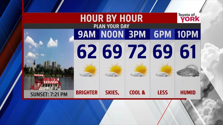
MORNING: Clouds continue to break up allowing for sunshine to return. There will be a noticeable chill in the air as lows drop to the mid 50s.


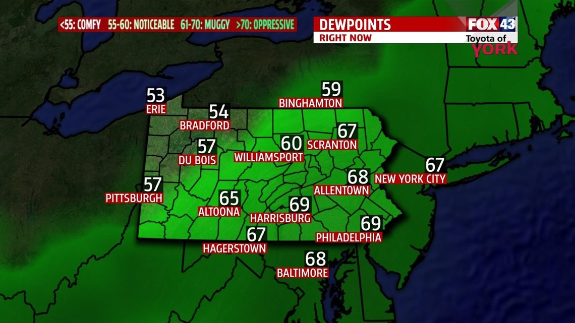
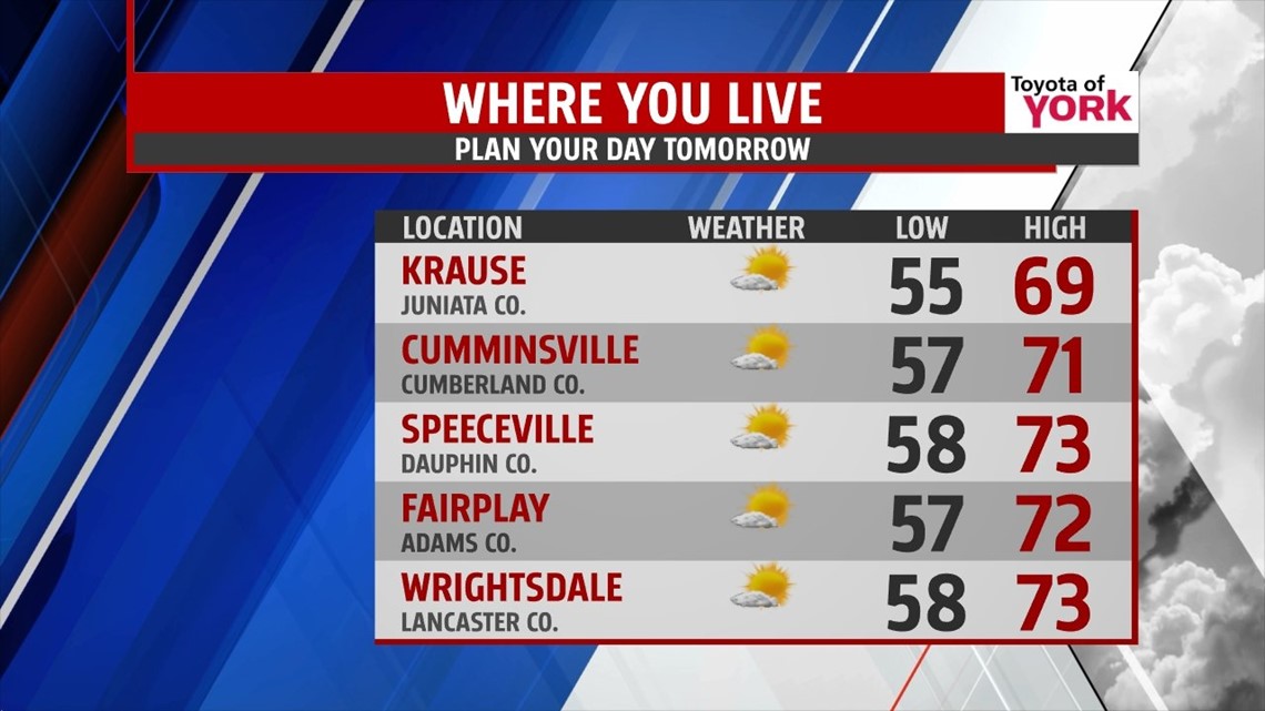
TOMORROW: Skies continue to brighten but will only warm to the upper 60s and lower 70s. It will certainly feel nicer as dew points dive back to the 40s and 50s. Great end to the week with a taste of fall. Friday evening looks great for football but you may need a jacket or sweatshirt before you head out.

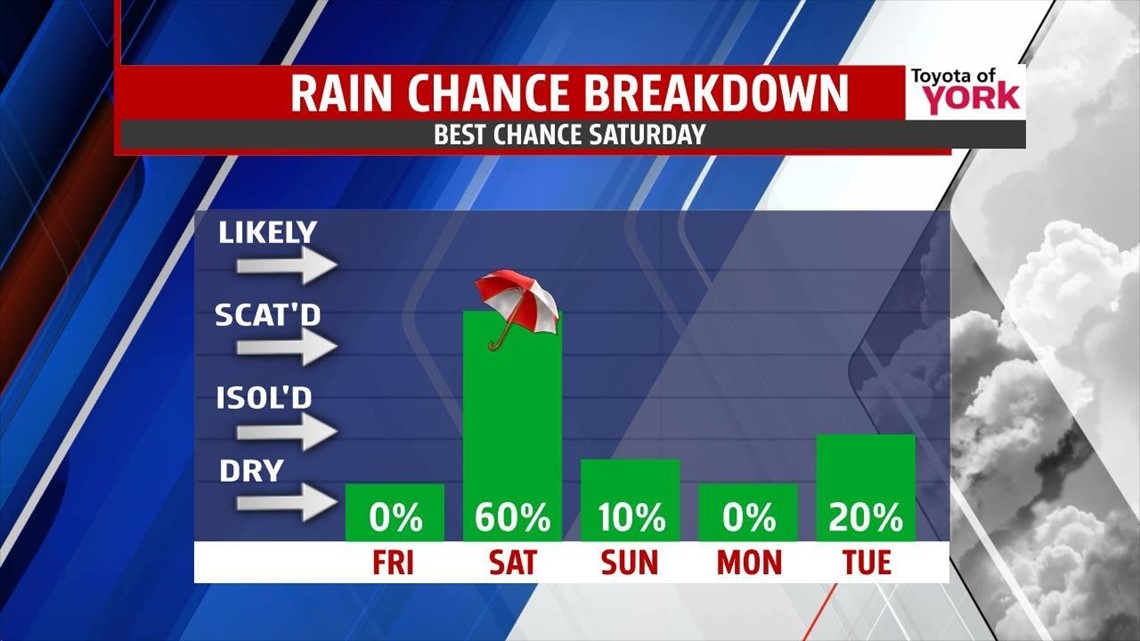
OUTLOOK: An upper level disturbance rotates in for the start of the weekend so the clouds will be returning Friday overnight. Scattered showers will be possible for Saturday. The combination of clouds and showers keeps temps in the 60s making for a chilly day. Sunday the clouds in the morning give way to a sunny afternoon. It will continue cool and below average with highs around 70. Into early next week, there looks to be a weak disturbance for Monday night into Tuesday morning that may produce a few light showers. Otherwise, we remain cool and dry for much of the week.

MaryEllen Pann, Chief Meteorologist
Like me on Facebook: maryellenpannfox43
Follow me on Twitter: @MaryEllenFox43
