

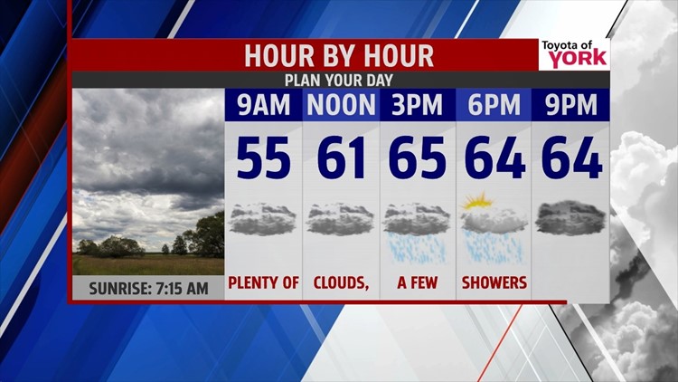

CLOUDS & SHOWERS RETURN

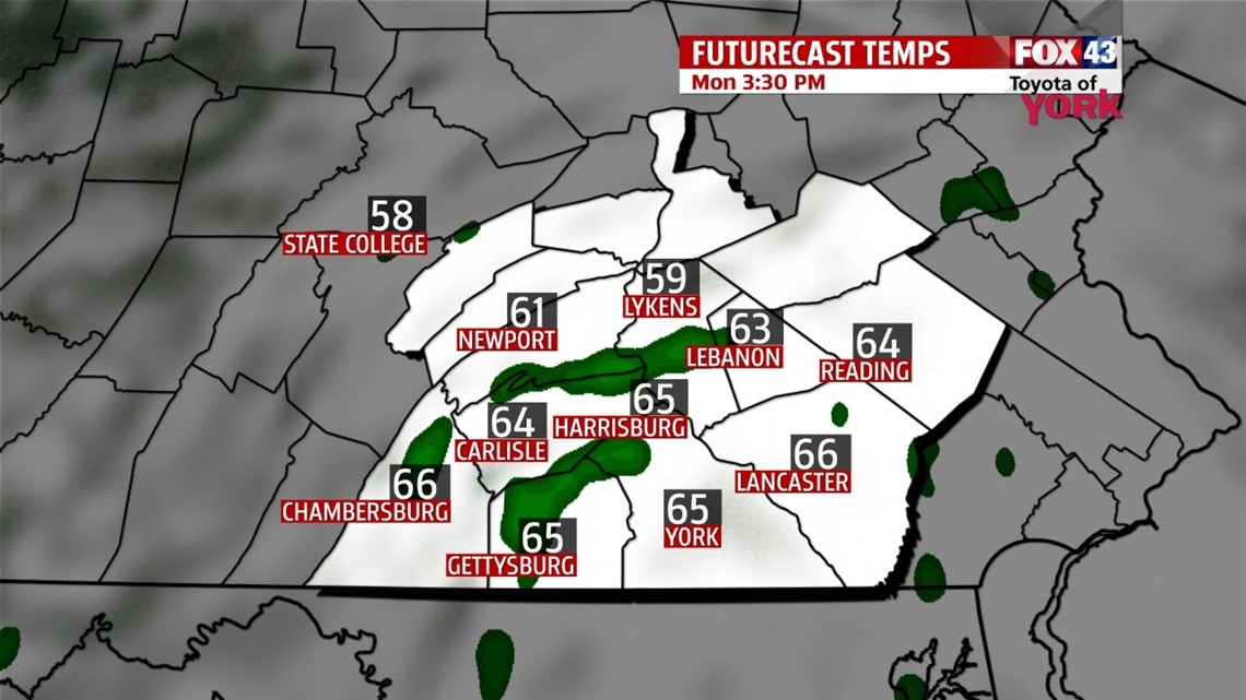
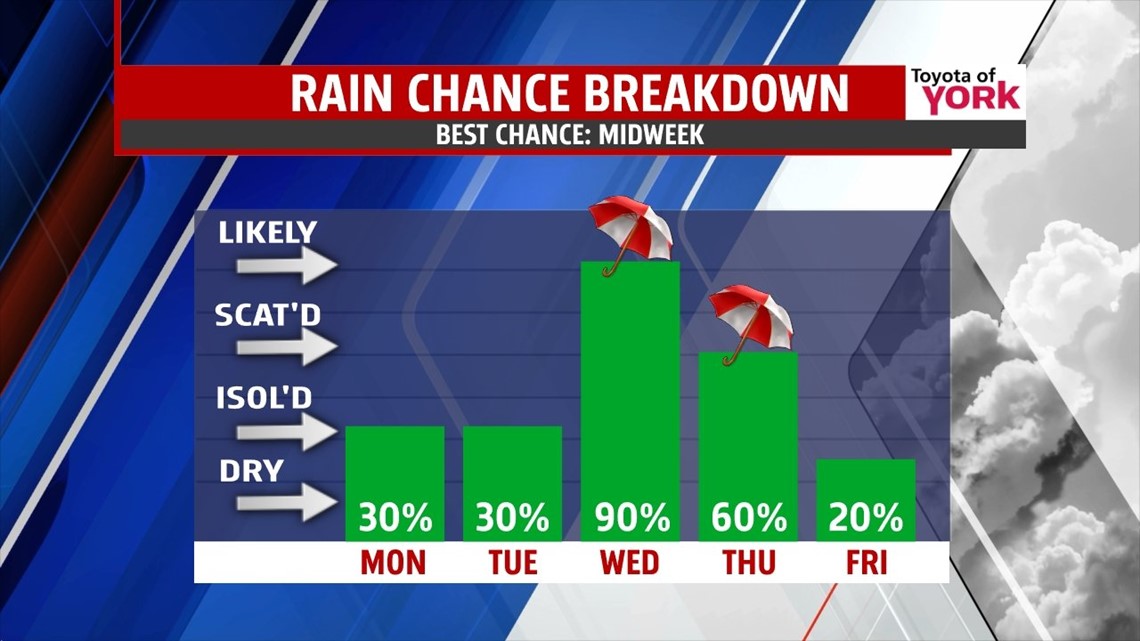
A weakening system is approaching from the south, and this brings a return to the clouds through the evening hours. A few drops are possible, but after midnight some showers are in store. Overnight lows won’t be nearly as mild, with readings in the upper 40s to lower 50s. The dreary conditions continue into early through the start of the workweek. There’s daily shower chances Monday and Tuesday, but only a few showers are expected each day. Highs will be in the middle 60s Monday, and the middle 70s Tuesday.
MIDWEEK SOAKER
By Wednesday, our next storm system approaches and brings a chance for a good soaking. There are some slight discrepancies currently in computer model timing, but either way you can expect Wednesday and Thursday to be the wettest days of the week. A drenching rain is expected Wednesday, with a few rumbles possible. Plenty of residual showers linger on Thursday. Highs are near 70 degrees Wednesday and fall into the 60s Thursday.
DRYING OUT
Friday a shower or two is still possible, but it’s a significantly drier day with some sunshine. Highs are in the upper 60s. A pool of cool air plunges into the area beginning on Saturday. Temperatures fall well below seasonable averages by Sunday, with readings in the 50s.
Have a great week!
-Andrea Michaels
