

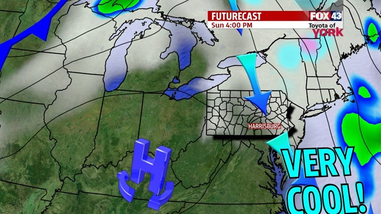

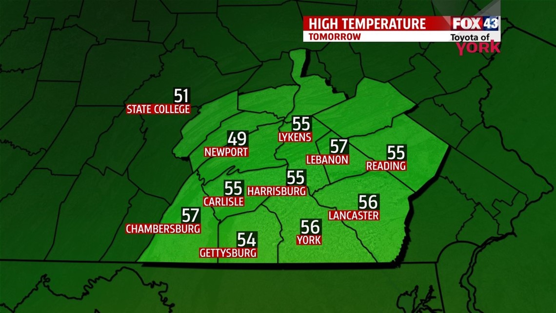
FALL CHILL SETTLES IN

Cooler air continues to spill into the region in the wake of a cold front that has pushed through the region Saturday. Clouds and a few drops stick around through the evening hours, but through the overnight the clouds begin to thin. It’s a chillier but seasonable night, with lows falling into the lower to middle 40s. High temperatures are well below seasonable averages on Sunday as the cool pool of air settles across the area. It’s a partly sunny, breezy, and chilly day with readings in the lower to middle 50s. The pattern remains cool leading into the beginning of next week too. After a cold, frosty start, Monday is dry with building clouds. Highs rebound a bit to near 60 degrees.
SHOWER CHANCES RETURN
Our next system arrives Tuesday, bringing cloudy skies and a few showers. The system stalls just off the Atlantic coast, keeping the clouds and shower chances around through the middle of the week. Temperatures are stuck below seasonable averages in the 50s Wednesday and Thursday.
SUNSHINE RETURNS
By Friday, the stalled system finally pushes east. This means skies dry out, and temperatures begin to bounce back near seasonable averages. Saturday, the sunshine continues. The pattern continues to warm, with highs in the middle to upper 60s.
Enjoy the rest of your weekend!
-Andrea Michaels
