

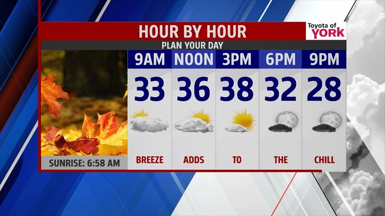
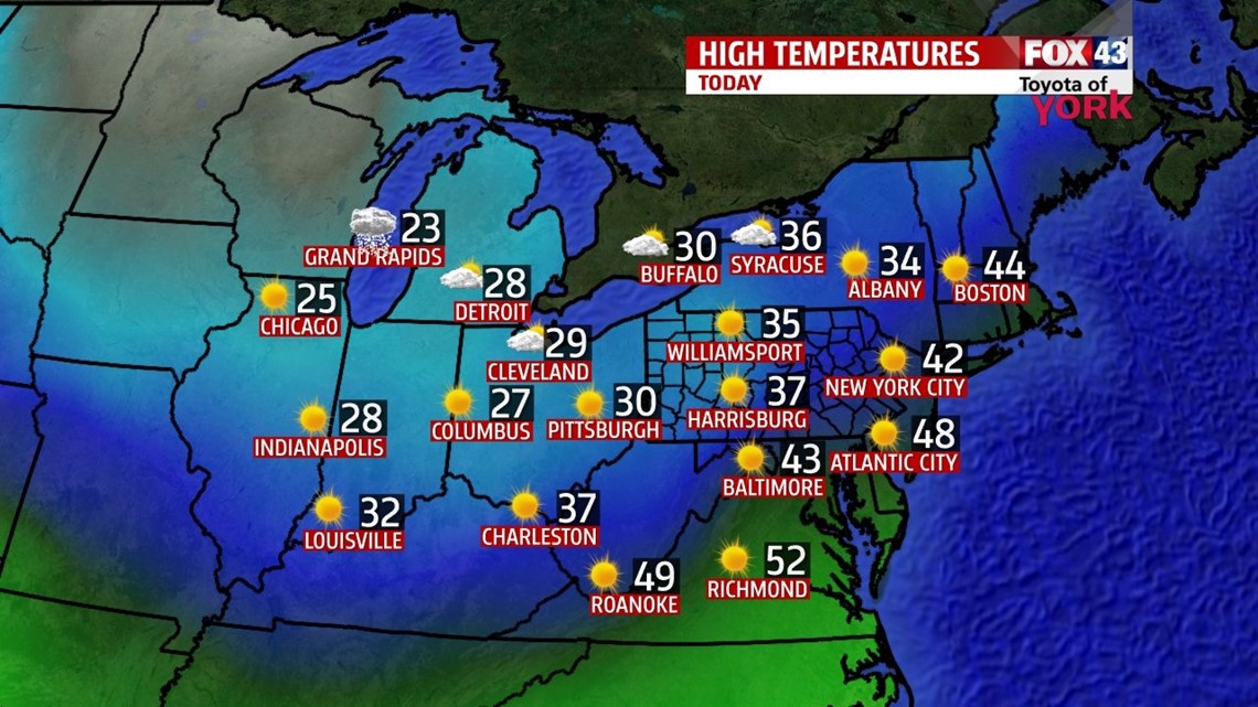
CLIPPER: A fast moving clipper will bring some early flurries and clouds to get the day started. Clouds should break by afternoon with more sun later. Highs will climb to the upper 30s with a westerly breeze. Another batch of colder air slips in later today into tonight. Lows drop to the lower 20s.

FRIDAY: Expect most sunny skies. It’s breezy and cold again. Highs top out in the middle 30s, still well below average. Evening plans look chilly yet again.


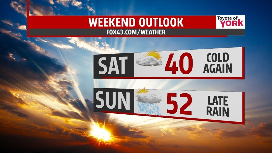
WEEKEND: As high pressure glides by to the south, we’ll see a morning sun fade to clouds late with highs nearing 40°. By Sunday, warming speeds up. A storm system builds to our south, sliding closer through the day. We are seeing clouds thicken all day, with highs near average in the low 50s. Showers arrive after dark, and continue into the overnight hours.

NEXT WEEK: We’ll see scattered showers around for Monday under mostly cloudy skies. Highs top out near 60°! As the secondary wave moves through on Monday, cooler air will slip back in overnight. Tuesday, it’s mostly cloudy with highs back to near seasonal averages, low 50s. Colder air slips in for Wednesday as we hit the roads for travel; we’ll be colder with highs in the 40s.
Enjoy your Thursday!
“You never run out of things that can go wrong.” – Edward A. Murphy
- Jeff Jumper, WPMT FOX43 Morning Meteorologist
Follow me on Twitter: @JeffJumperWX
Like me on Facebook: Jeff Jumper FOX43
