

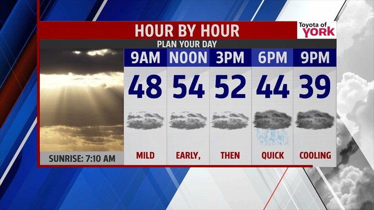
SHOTS OF WINTER: With the long weekend may be over for most of us, we’re moving toward the warmest day of the week. Highs today will climb to the middle 50s under cloudy skies. A cold front is moving through, so we’ll see a few showers bubble late as temps fall quickly into the evening. We drop to the near 30° by daybreak Tuesday. We need to closely watch some precip near the PA/MD border which could start the morning with an icy mix. Stay alert.


The cold air slips in for Tuesday, but a system nudging in from the south will slowly warm us rolling late into the day and overnight. It’s cloudy with a spotty shower mix of snow and sleet turning to rain as we move into the afternoon. Accumulations will be minor and mainly in the elevations, but we could see some slick spots for the midday and evening drive. Again, stay alert. Highs are in the middle 30s.

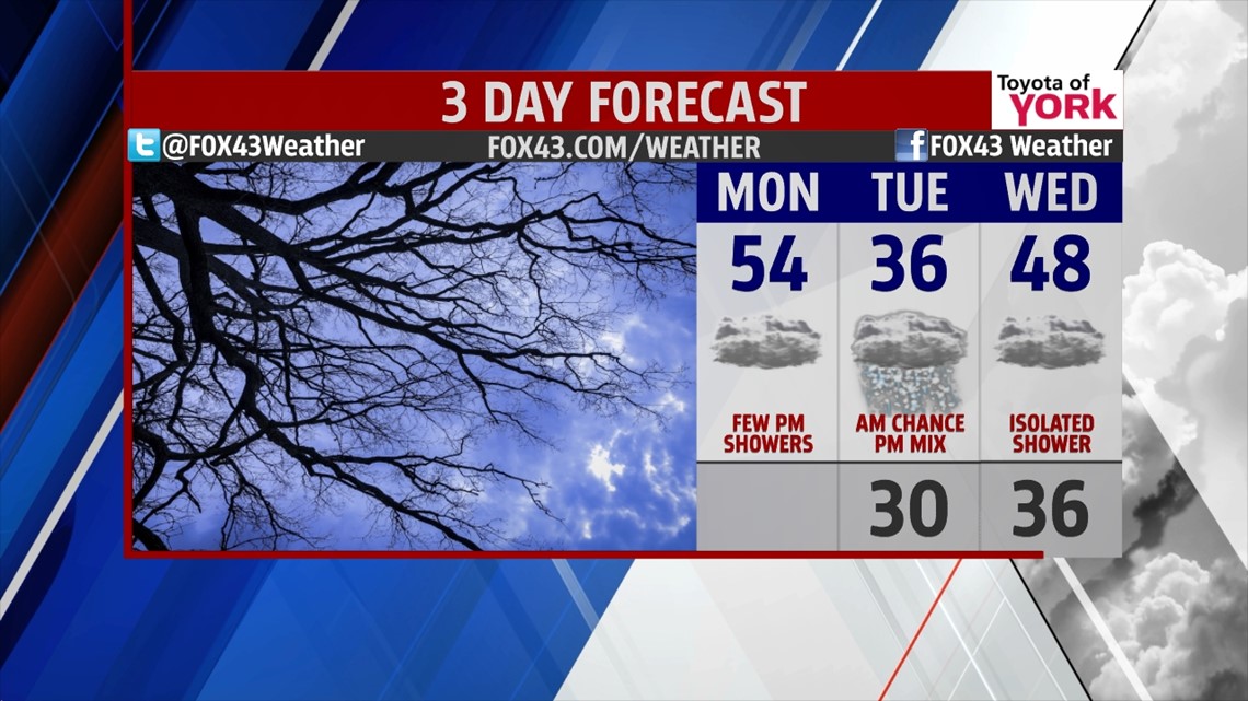
MIDWEEK: As the storm systems clear for Wednesday, we stay cloudy while warming a bit. Expect highs in the upper 40s with only a leftover shower possible. Thursday, we’re partly cloudy and dry. Some cooler air begins to slip in. Highs hit the middle 40s.
INTO THE WEEKEND: A slow moving system slips over our area for the weekend, bringing the daily chance for showers from Friday into Sunday. Expect generally cloudy conditions with periods of showers. Friday is the coolest at 42°, with Saturday at 46°, and Sunday at 48°.
Have a marvelous Monday!
“The value we place on what we've been given correlates to our depth of gratitude for it.” – Todd Stocker
- Jeff Jumper, WPMT FOX43 Morning Meteorologist
Follow me on Twitter: @JeffJumperWX
Like me on Facebook: Jeff Jumper FOX43
