


COLD START TO NEW YEAR
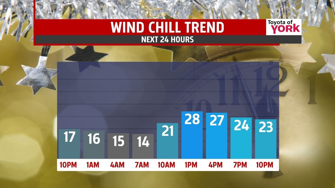
A potent area of high pressure has cold air locked in place, so we’re slow to warm through the end of the week. This means a frigid New Year’s Eve forecast. Wherever your travels may take you, be sure to bundle up! Temperatures fall into the 20s this evening, with wind chills in the teens. Overnight temperatures on New Year’s Eve are in the frigid lower 20s, with some spots falling into the teens under clear skies. On New Year’s Day, we’re still quite cold, with highs climbing into the middle 30s. Friday is dry with plenty of clouds. High temperatures are near 40 degrees.
UNSETTLED WEEKEND


Into the weekend, our next storm system slowly approaches. Clouds build Saturday, with a late day shower possible. Overnight Saturday into Sunday, the system brings a chance for showers, likely starting as freezing rain through the night and very early Sunday morning before quickly changing to rain. The best chance to see freezing rain will be along the higher hilltops and higher elevations throughout the area. Temperatures are expected to run above seasonable averages in the 40s after a chilly start.
ANOTHER COLD BLAST
Another cold burst of air looks to settle into the region again early next week. Highs are knocked back into the lower 30s Monday with a mixture of clouds and sunshine. Tuesday looks even colder with highs near the freezing mark. There is also the chance for a few snow showers as weak disturbance moves close to our region. Wednesday is still looking quite frigid, with temperatures near 30 degrees.
Have a great night!
-Andrea Michaels
