


NOT AS COLD/MORE SUN
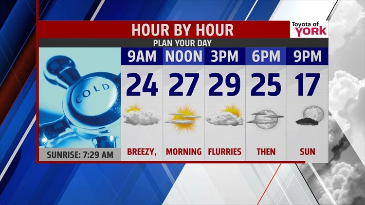
Clouds are back across the area with some flurries, and perhaps a few snow showers this morning. A quick moving system is the cause, and as it rapidly exits through the morning, skies clear out. This means more sunshine for the afternoon, but temperatures do manage to reach the middle to upper 20s across our region. It’s a breezy day, with wind chills in the teens at times. The overnight period is mostly clear and cold, with lows falling into the single digits yet again.
WEEKEND STAYS COLD


A burst of colder air works back into the region Saturday. Despite sunshine and some passing clouds, high temperatures only reach the middle teens to near 20. With breezy conditions continuing, you can expect wind chill values in the single digits at times, especially during the morning hours. Sunday brings a mixture of clouds and some sunshine, but it is dry. Highs moderate a bit, reaching close to 30 degrees.
ACTIVE PATTERN NEXT WEEK
Next week’s pattern turns more active as the brutally cold air slowly retreats. Monday, a system could bring a light wintry mix to area. Tuesday we catch a bit of a break with more sunshine, but it’s still cold. Wednesday is cold as well with partly cloudy skies. Then another weak system threatens the area again with a wintry mix or snow on Thursday. Highs reach the lower to middle 30s through that timeframe.
Have a great weekend!
-Andrea Michaels
