
THIS EVENING
It should be a quiet and dry evening as high pressure builds in. Skies are clear but the clouds will return later tonight as our next system heads east. Winds will die down some too. Temperatures will fall from the low 20s to the mid teens but any breeze will add to the chill.
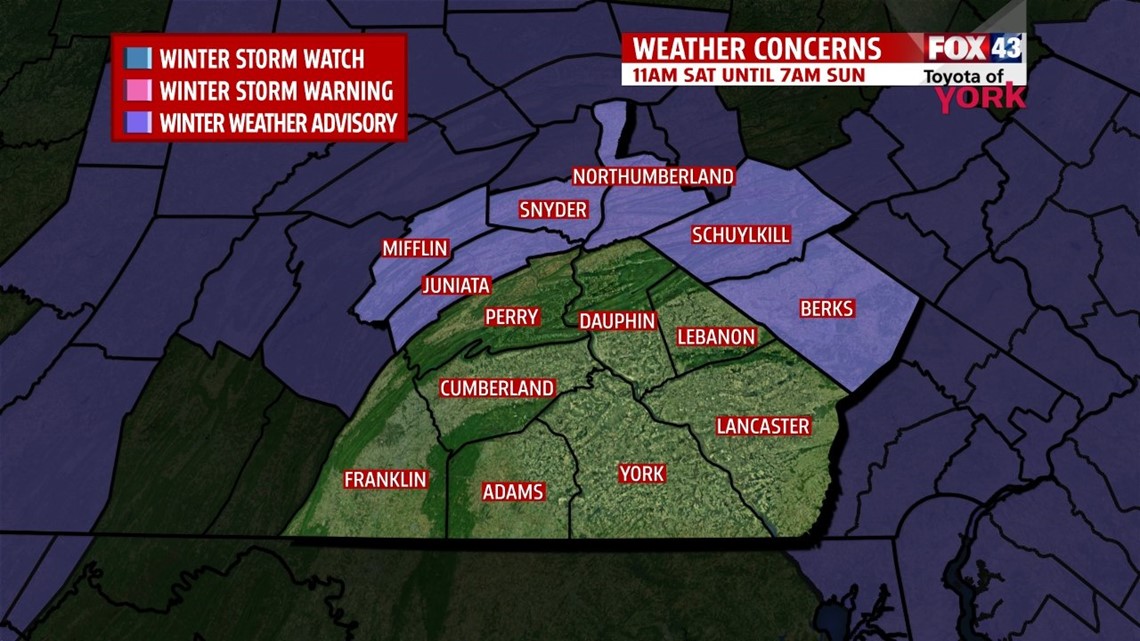
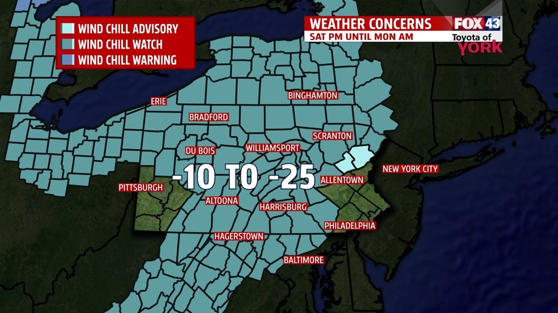
WINTER WEATHER ADVISORY just issued for Mifflin and Juniata counties from 11am Saturday until 7am Sunday. Expect 2 to 4 inches of snow from dangerous snow squalls that will accompany a very potent Arctic front. Wind chills may run as cold as -20 to -30 in this area. Blowing snow and dangerous winds chills expected late afternoon and through the evening.


VALENTINE’S DAY
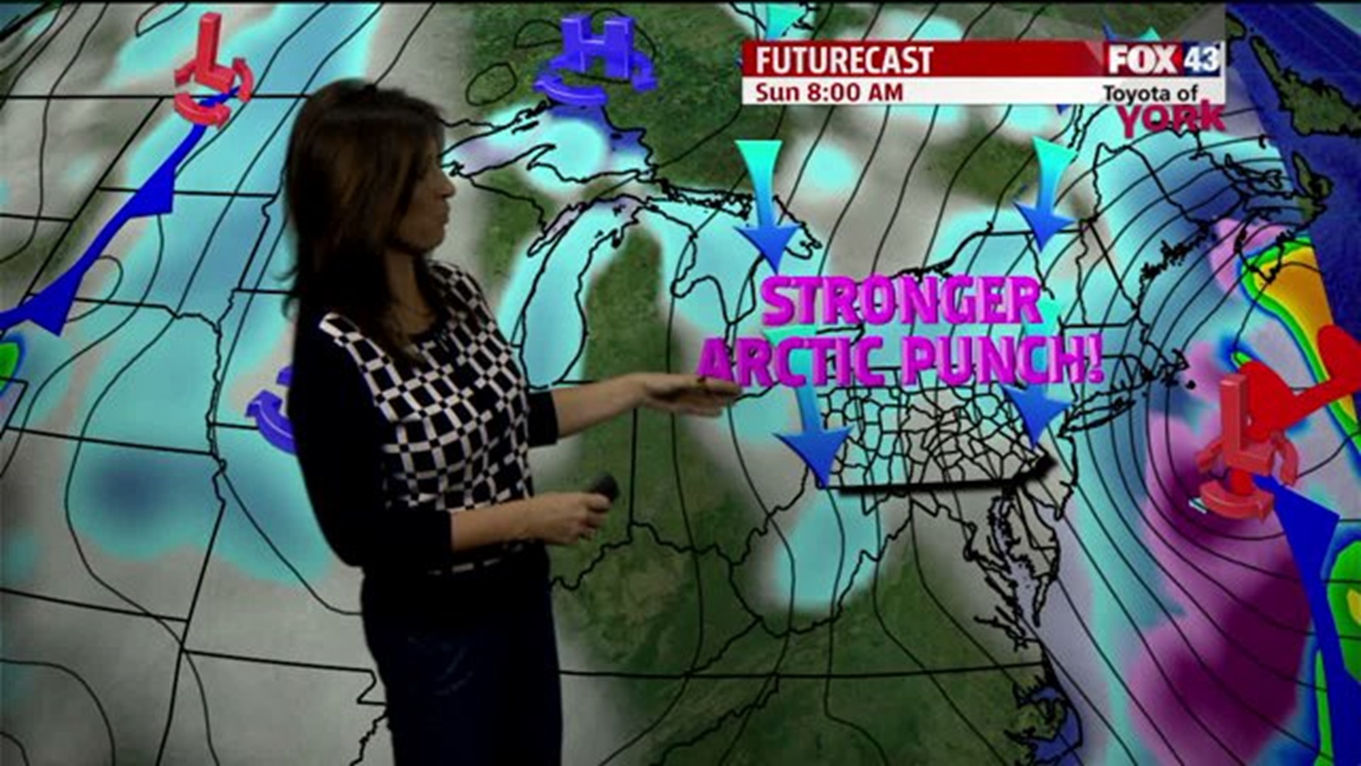
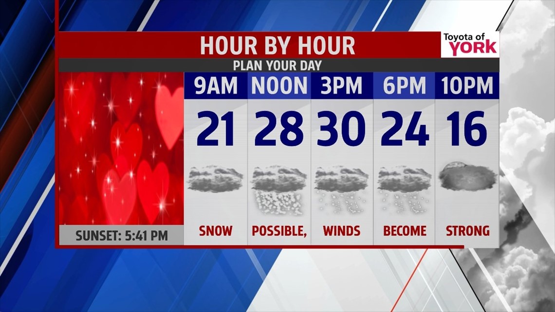
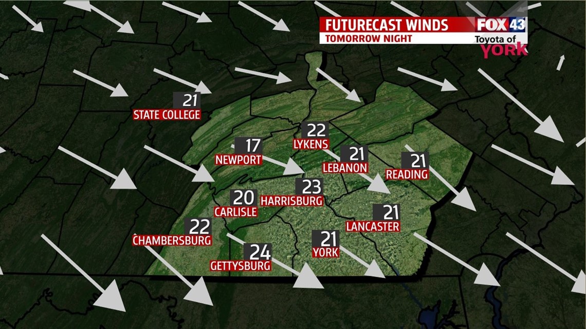
It should be a cold but quiet morning with lows in the low teens. Our next clipper swings in on Saturday slamming the area with colder air and much stronger winds. It is likely to produce widespread snow too. There may be dangerous snow squalls which could put down a quick amount of snow and rapidly limit visibility. We could see the first flakes as early as 11am and it looks like our snow chance ends by 7pm. Highs expected near 30.


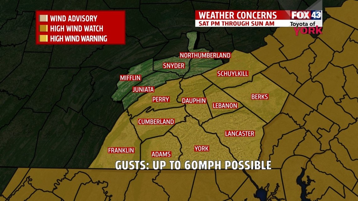

Another concern with the winds will be the dangerous wind chills. A WIND CHILL WATCH goes into effect Saturday night through Monday morning.


OUTLOOK
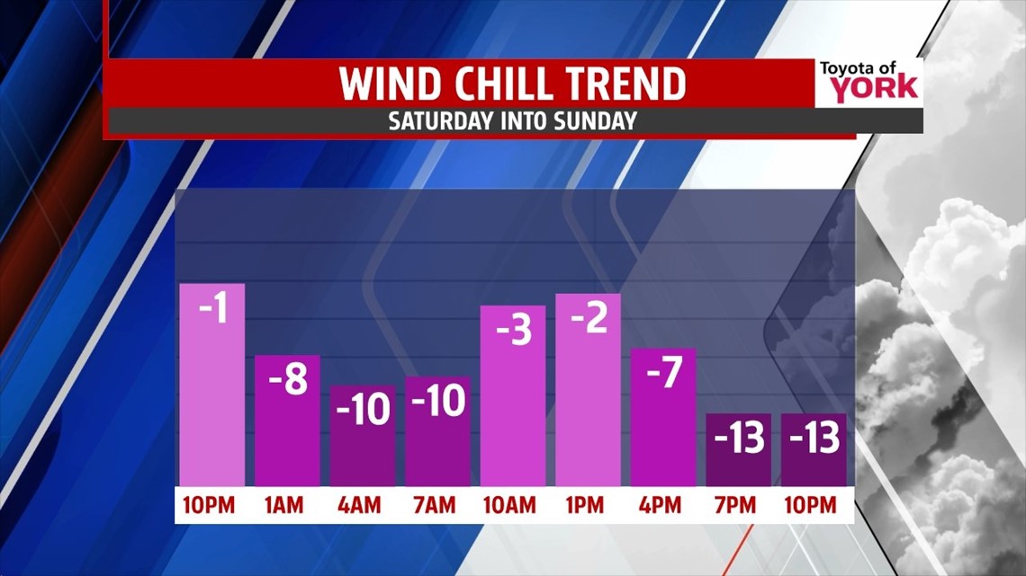
Temperatures Sunday may be warmest early in the teens and fall to the single digits late in the day. Combine the strong winds and wind chills will be running well below zero once again. Sunday night into Monday morning will be the coldest by far and could come close to tying or breaking the morning low of 0 set in 1904 and 1905. Either way prepare for a very, very cold morning. Highs will fall short of seasonal averages only climbing to the upper teens despite mostly sunny skies. Tuesday and Wednesday we’ll see a bump in temperatures but not for long. A deepening trough settles in over the east coast and temperatures will once again plummet to the single digits with highs only in the teens. The mid week storm now looks to stay south but if something changes will be sure to let you know.
MaryEllen Pann, Chief Meteorologist
Like me on Facebook: maryellenpannfox43
Follow me on Twitter: @MaryEllenFox43