


SNOW LIKELY TONIGHT

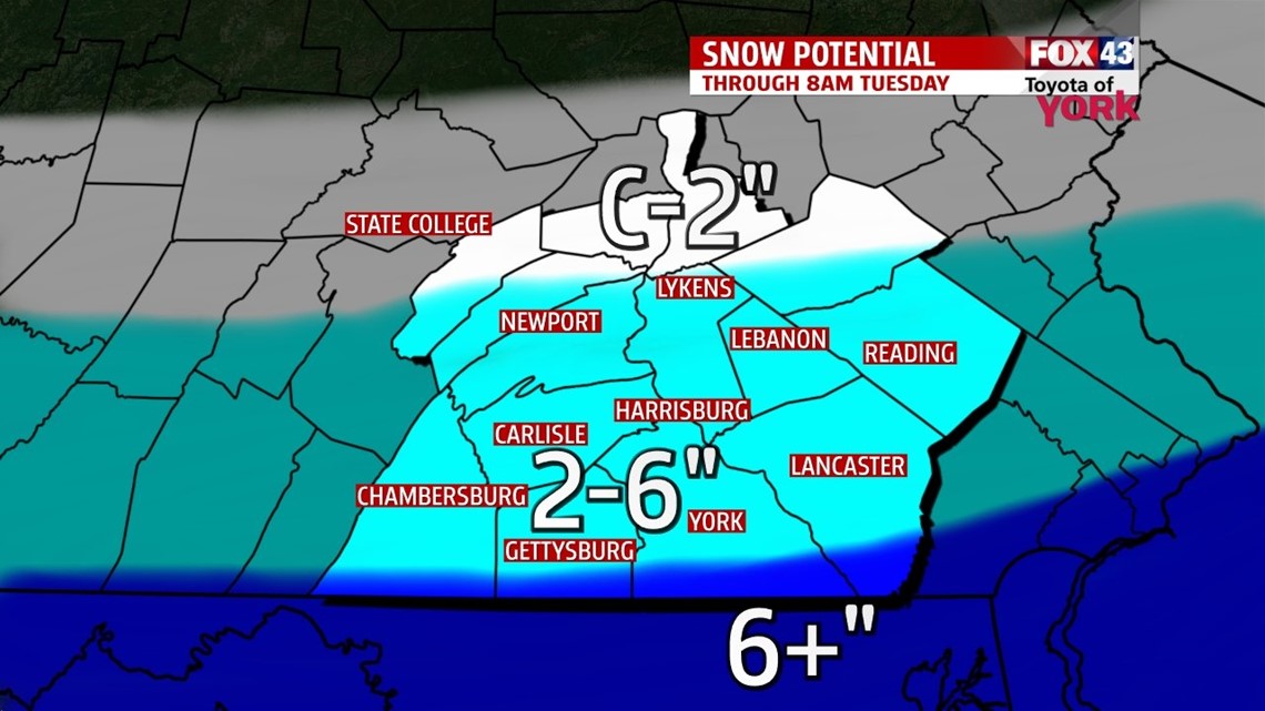
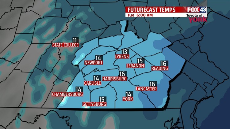
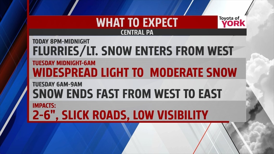
Clouds have quickly increased ahead of a storm system that brushes our region with snow through the night. Flurries and light snow arrive from 8 P.M. to midnight, and becomes a light to moderate snow afterward. Cold temperatures make for a light, fluffy snow, so it piles up quickly through the night. Expect reduced visibilities and slippery roads lasting into the morning commute. The snow tapers quickly west to east from 6 A.M to 9 A.M. on Tuesday. A general 2-6” is likely throughout the area, but we can’t rule out the potential for more close to the Mason-Dixon line depending on how far north the heaviest snow tracks.
MORE ARCTIC AIR
In the wake of tonight’s snow, more brutally cold arctic air closes out the workweek. Some snow showers will be possible at times as the next blast arrives on Wednesday. High temperatures creep into the 20s, only to plummet once again. Thursday and Friday look like a repeat of the bitter cold from the last couple of days. Expect afternoon highs in the teens, and lows in the single digits to below 0 degrees.
WEEKEND
Saturday temperatures rise back into the 20s, and we’ll be watching the development of yet another storm system for possible impacts across our region through Sunday. We’ll keep you posted. Monday is still frigid, with partly cloudy skies and highs in the 20s.
Have a great night!
-Andrea Michaels
