

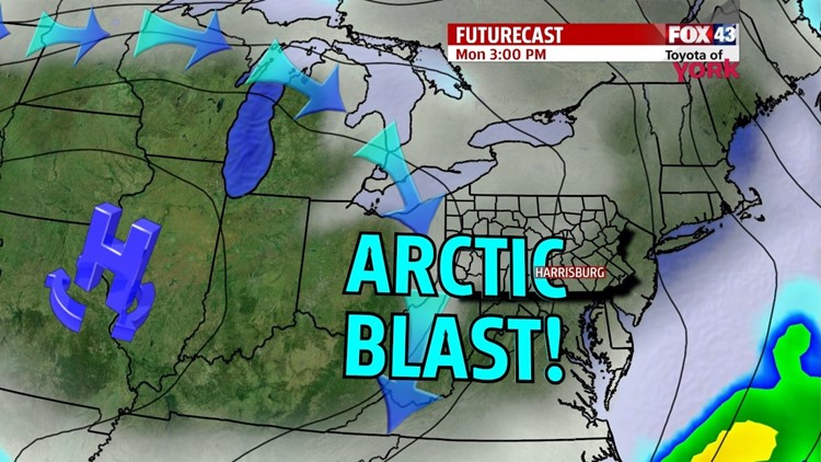

BRIEF ARCTIC BLAST

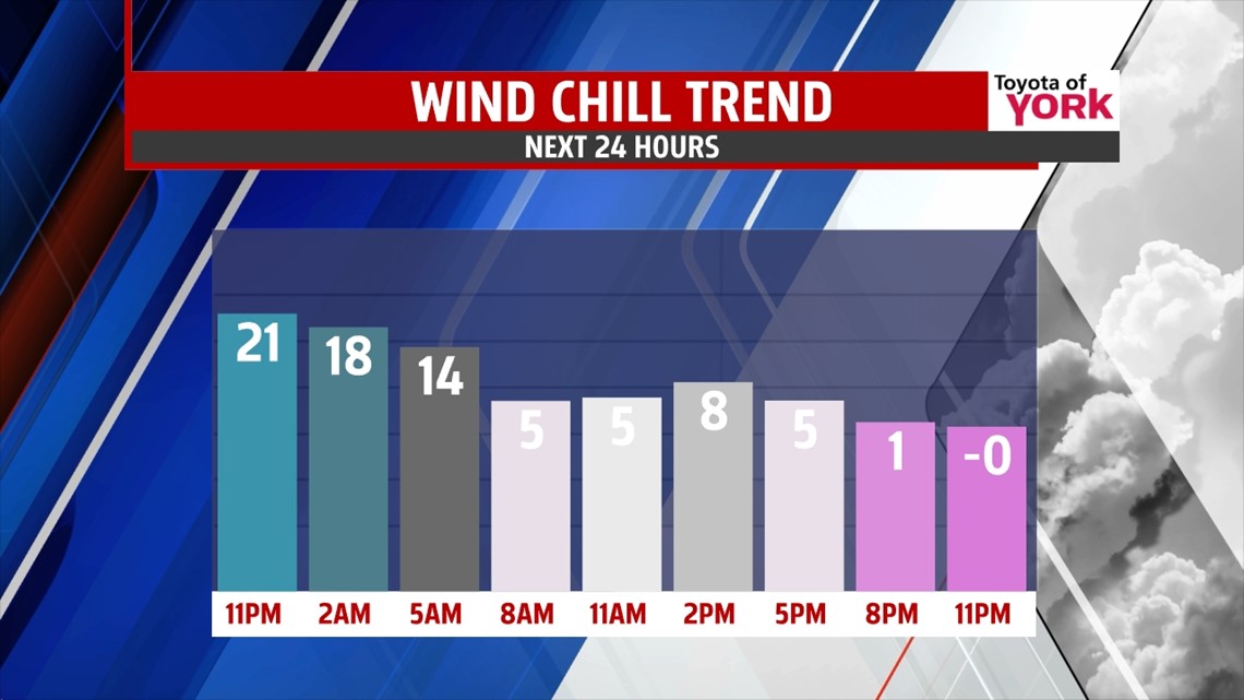
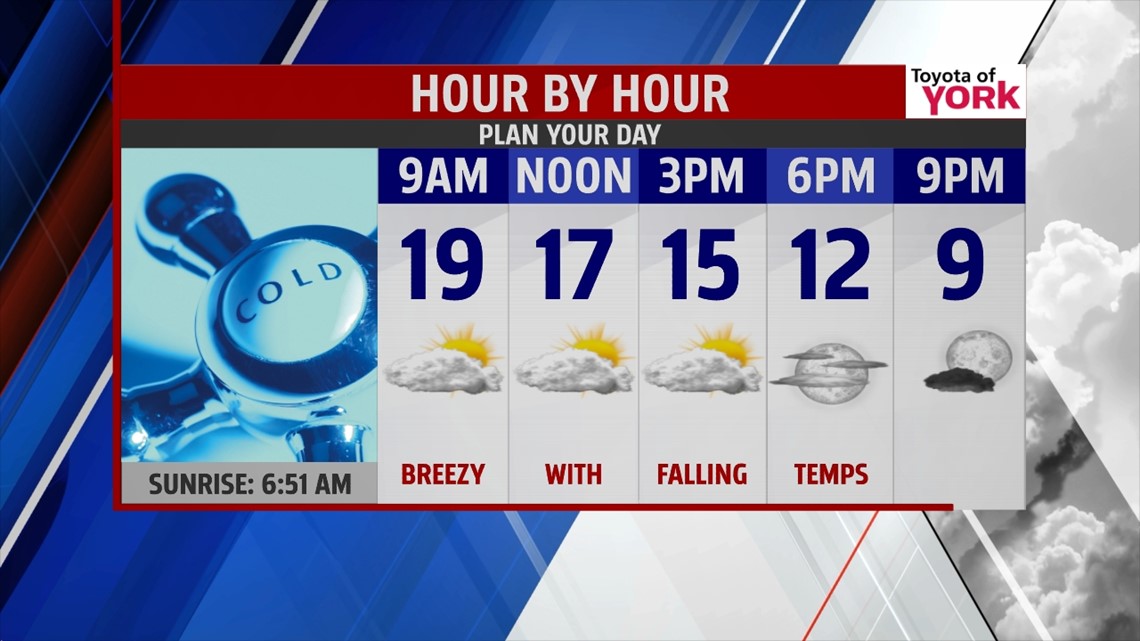
High temperatures today were much closer to seasonable averages for this time in February. However, arctic air begins to pour back into the region tonight. High temperatures occur near midnight, in the middle to upper 20s, and fall through the morning and afternoon hours into the teens and single digits. Breezy winds bring back cold wind chill values too. This leads to another brutally cold morning Tuesday, with lows near 0. It’s out of here by Wednesday, and temperatures are a little closer to seasonal averages for this time of year.
ANOTHER ARCTIC INTRUSION
Another shot of arctic air plummets into the region for Thursday and Friday. Expect lows in the single digits Thursday and perhaps near 0 on Friday morning. Afternoon highs are in the lower to middle 20s. There will at least be plenty of sunshine throughout the region.
WEEKEND
The frigid, below average air stays lodged in place for the first half of the weekend. Saturday, some clouds build through the day, and after a chilly start, afternoon high temperatures reach the middle to upper 20s. Sunday, temperatures look to warm much closer to seasonable averages as we welcome the month of March, near 40 degrees. It will come with the chance for rain showers.
Have a great week!
-Andrea Michaels
