

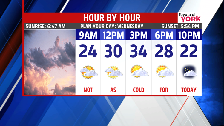
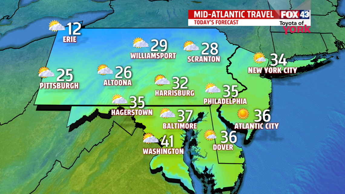
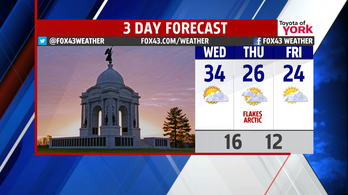
SMALL BUMP UP: Today will be the “warmest” day of the week, just ahead of another batch of cold air for the end of the week. Expect mostly cloudy skies and highs in the lower to middle 30s. It’s still well below average for the day. We’ll feel the colder air spilling back in overnight though as we drop to near 15°.

MORE ARCTIC: We’re in for two more days of arctic air to close out the week. Expect sun and clouds mixing with highs nearing 26° on Thursday and 24° on Friday. A few snow showers are possible on Thursday which could put down a quick dusting or so in spots.

WEEKEND: Saturday, we hold highs in the middle 20s under plentiful sunshine. Sunday, we’ll see clouds return. Highs are now into the middle 30s.
NEXT WEEK: Monday is milder yet with highs in the lower 40s. We start out with a brief mix. We’re mostly cloudy. Rain to mix chances return Tuesday into Wednesday as our next system approaches with highs near 40°.
Have a wonderful Wednesday!
“The only place where success comes before work is in the dictionary.” – Vidal Sassoon
- Jeff Jumper, WPMT FOX43 Morning Meteorologist
Follow me on Twitter: @JeffJumperWX
Like me on Facebook: Jeff Jumper FOX43
