

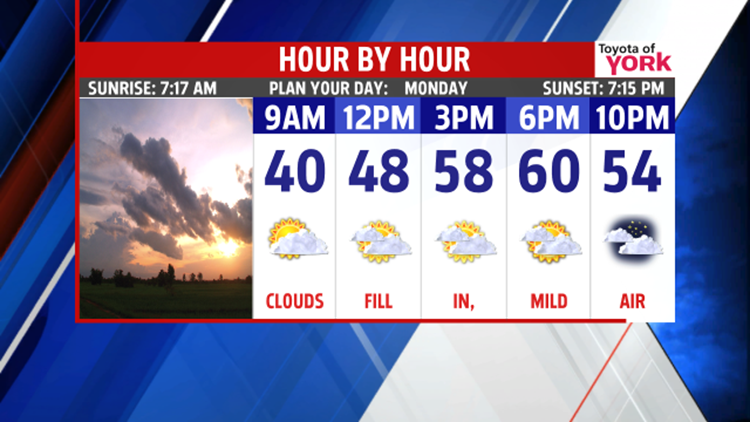
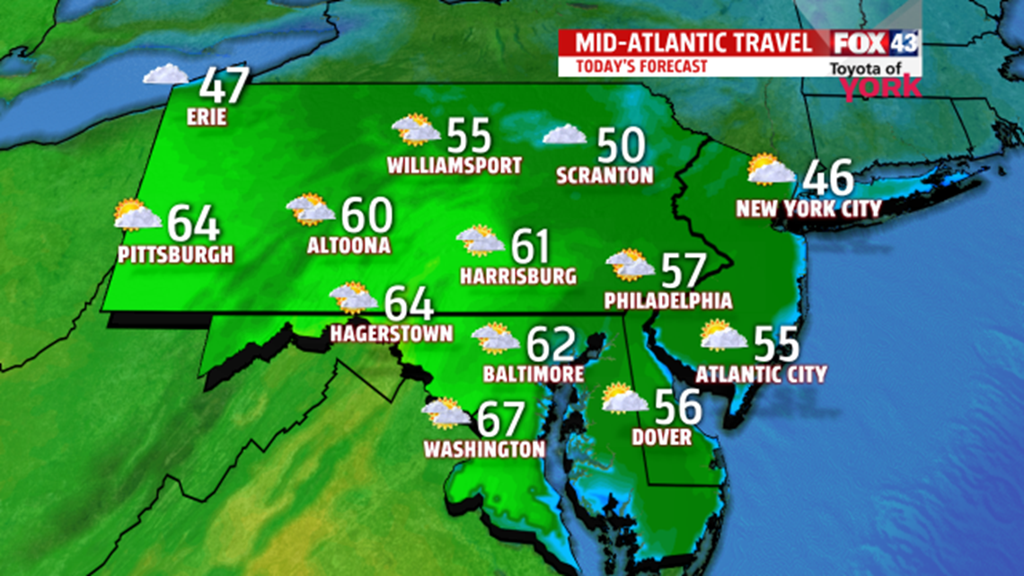
QUIET STRETCH: We’re looking to stay dry and quiet just about all week long here. Monday starts on a mild note with highs near 60° under mainly cloudy skies. We drop to the middle 40s tonight.

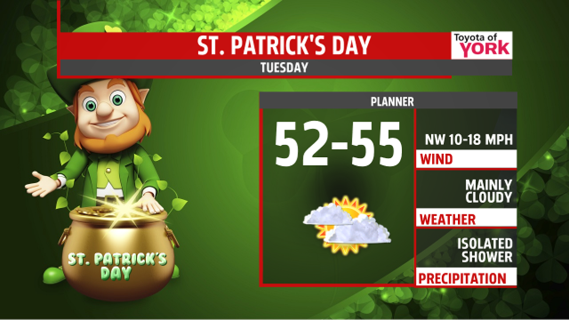
A front rolls through Tuesday with the chance for a few drops. Highs touch the middle 50s before colder air races in later in the day.

Temps drop to the 20s overnight, only rebounding to the 40° mark for Wednesday with a chilled breeze, despite sunshine. We’ll be back to the middle 40s under partly cloudy skies for Thursday.

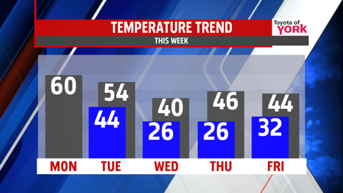
LATE WEEK QUESTIONS: We’re watching a wide variety of solutions for the end of the week, form sunshine and mild air, to colder weather with rain or snow. Right now, we’re holding a mainly cloudy day with the chance for a mix to rain showers on Friday. Highs are in the middle 40s. This forecast is highly uncertain and changeable, so check back.
WEEKEND: The late week forecast will impact the weekend plans, but for now we’re looking at a mostly cloudy Saturday with highs nearing 50°. Sunday, we’re back to the middle 40s under partly cloudy skies. More to come.
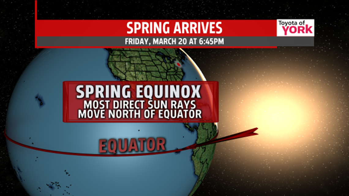
SPRING EQUINOX: Friday marks the start of spring. At 6:45PM EDT, the sun’s direct rays will sit directly over the equator. For the next six months, we’ll see the sun’s most direct rays in the northern hemisphere.

Have a miraculous Monday!
“No matter how long the winter, spring is sure to follow.” – Proverb
- Jeff Jumper, WPMT FOX43 Morning Meteorologist
Follow me on Twitter: @JeffJumperWX
Like me on Facebook: Jeff Jumper FOX43
