

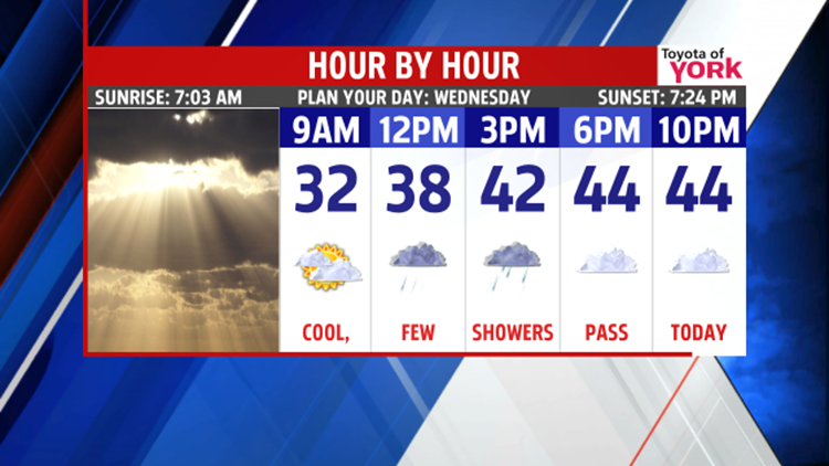
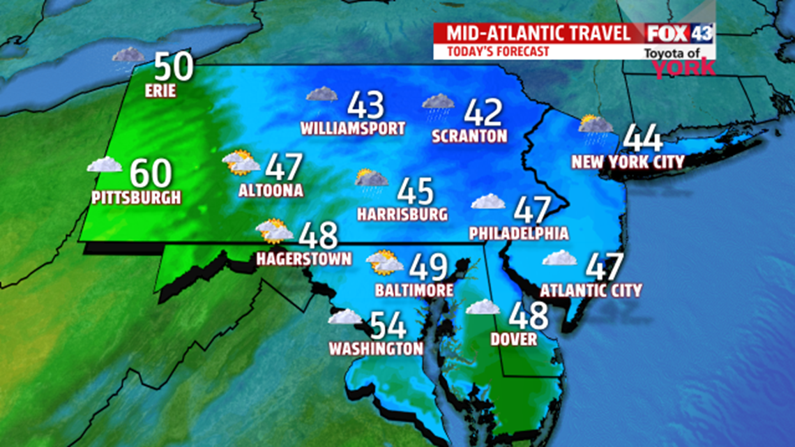
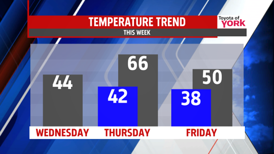
GLOOMY: Clouds will return this morning and hang tough today as we watch a warm front slowly move through the region. Expect a few early showers and then spotty showers again in the afternoon. We’ll only make it to the lower to middle 40s for highs today. Overnight, we hold temps in the lower 40s as warmer air prepares to surge into the state.

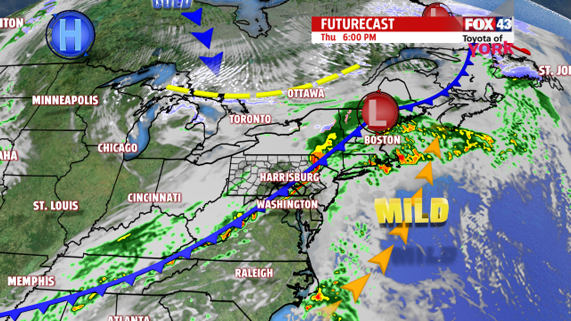
WARM & STORM: Southerly flow will help to pump in milder weather for the day Thursday. As a cold front approaches, temperatures will slide into the middle 60s. We’ll see a few early showers with a break for midday. Then, by late afternoon, another batch of rain moves through with heavy downpours and a few thunderstorms possible too. The rain tapers lingers into the overnight with temperatures dropping quickly to the upper 30s.

FRIDAY: Cooler air continues to move in on Friday with isolated showers lingering. It becomes breezy too. Expect highs near 50°.

WEEKEND: A cold chunk of air sags south for the weekend. Saturday looks partly cloudy with highs struggling to move toward 40°. We may see a few flakes fly. Sunday, we do start to warm a tad, but we’re still cool with temps in the middle to upper 40s.
NEXT WEEK: We continue to moderate but we’re still a handful of degrees cooler than average for the first half of the week. Highs are in near 50° Monday under partly cloudy skies. We may see a few early flakes or drops. Tuesday, cool air holds on with temps in the upper 40s.
Have a wonderful Wednesday!
“My philosophy is: If you can't have fun, there's no sense in doing it.” – Paul Walker
- Jeff Jumper, WPMT FOX43 Morning Meteorologist
Follow me on Twitter: @JeffJumperWX
Like me on Facebook: Jeff Jumper FOX43
